|
LOCATION |
THUMBNAIL
IMAGE |
THUMBNAIL
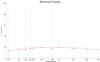
SPECTRA |
|
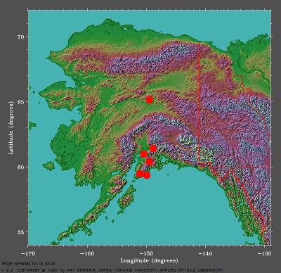
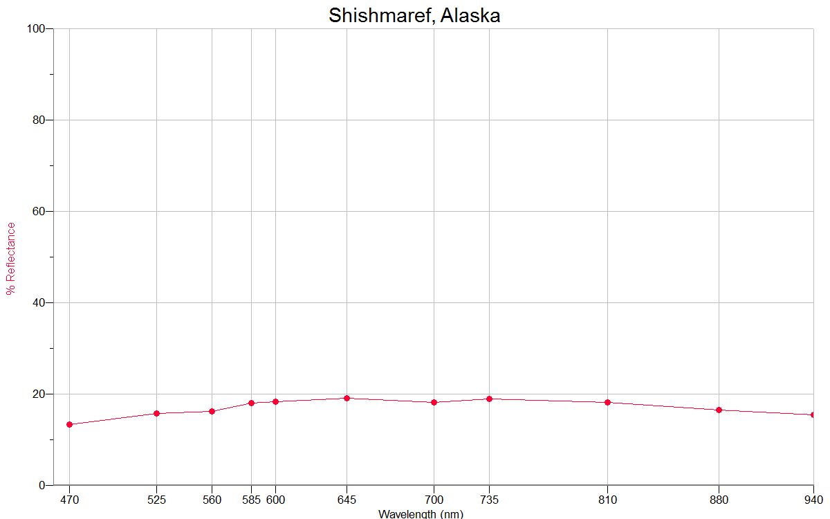
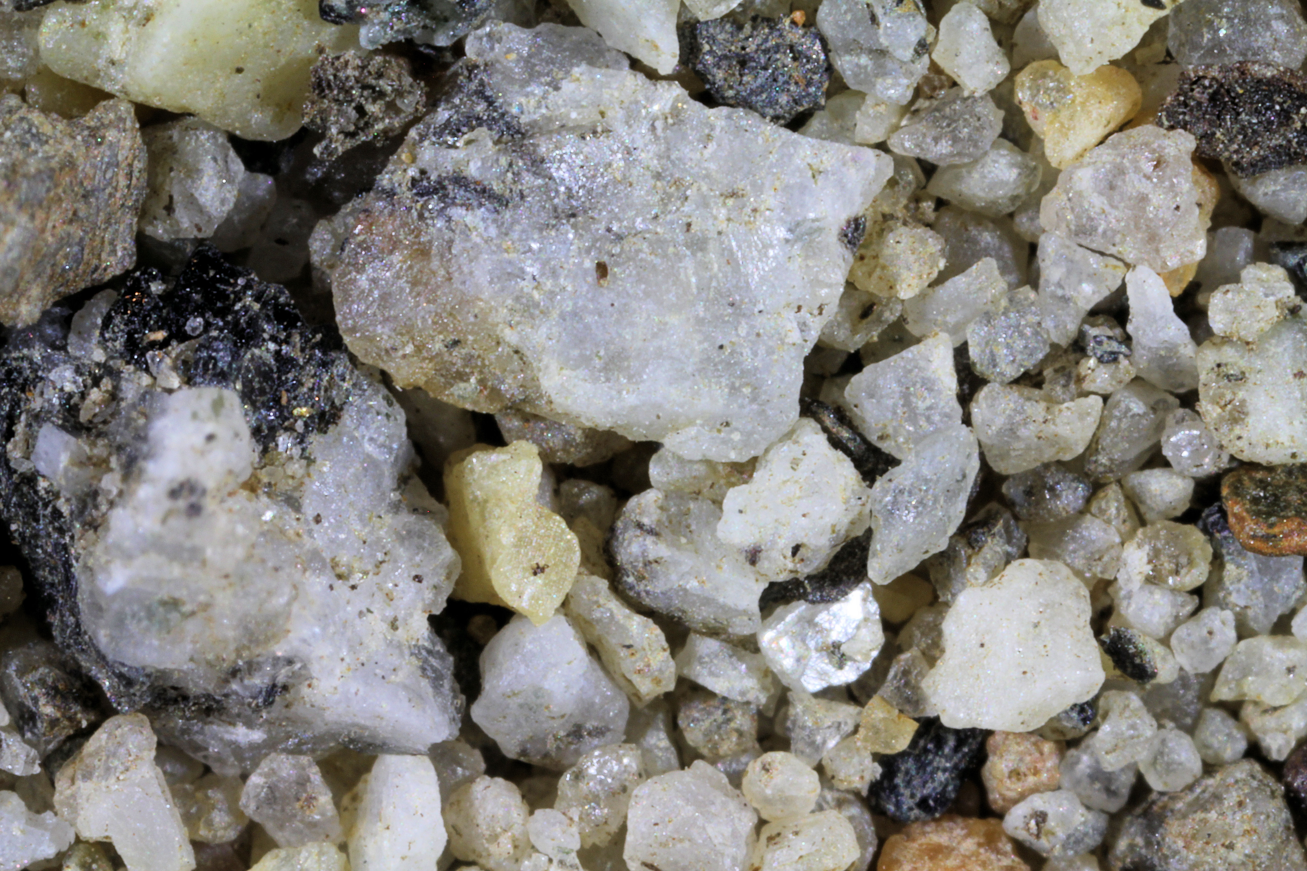
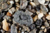
SHISHMAREF
66.26N, 166.07W |
 |
 |
|
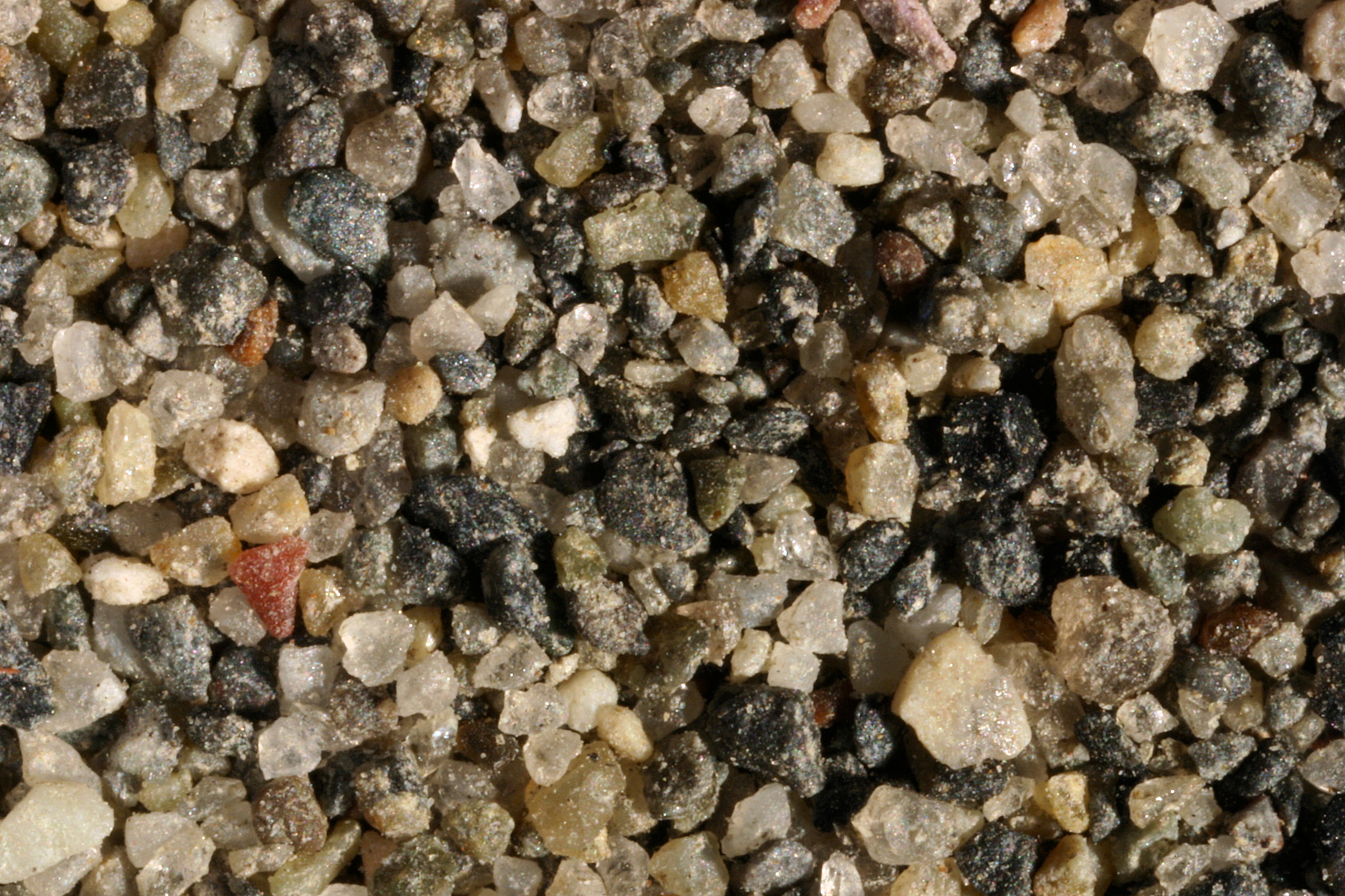
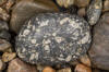
BREVIG MISSION 65.33N, 166.49W |
 |
|
|
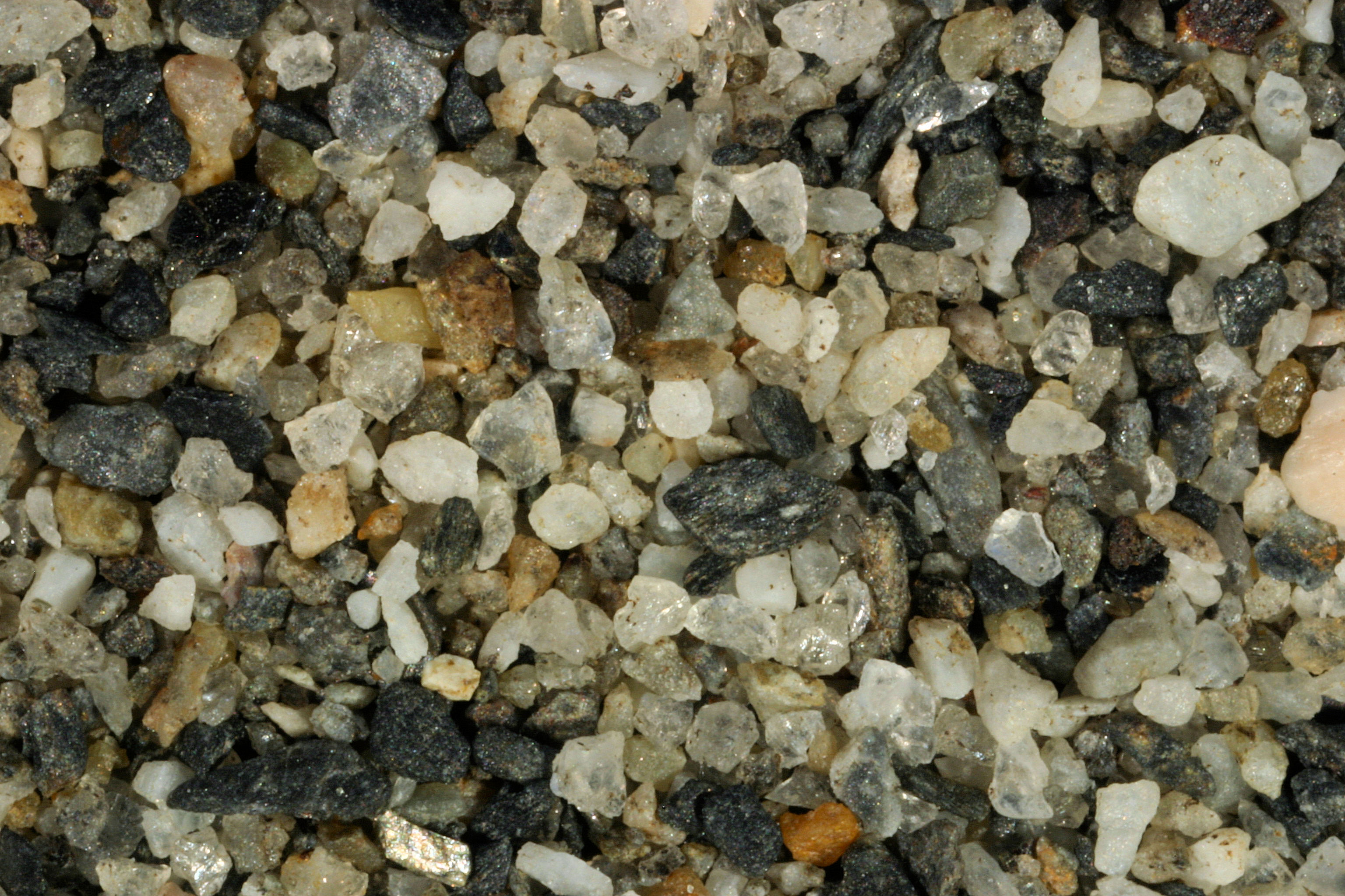
TELLER (0X) 65.26N, 166.35W |
 |
|
|
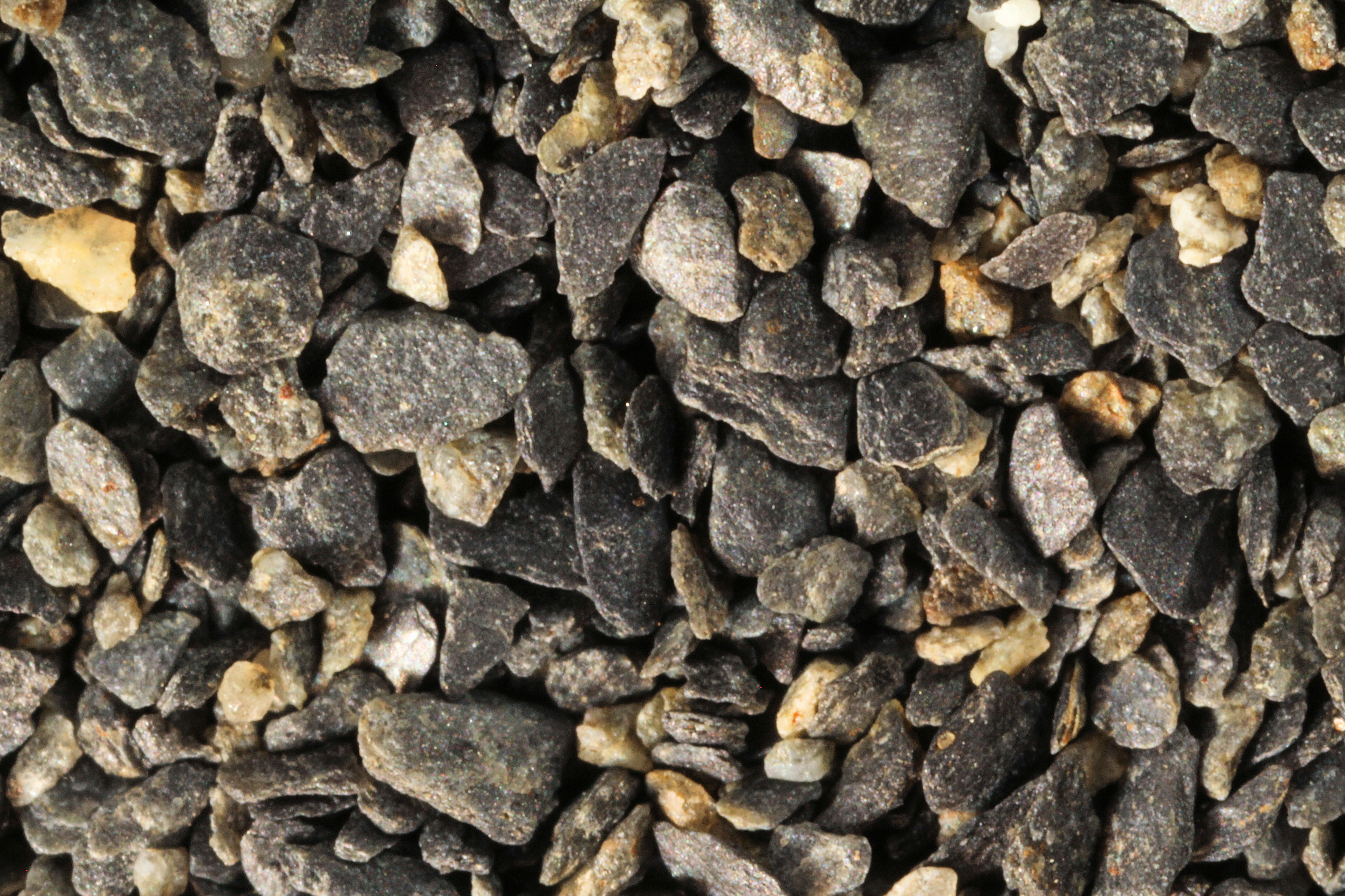
BAKER LAKE, 65.03N, 150.37W |
 |
|
|
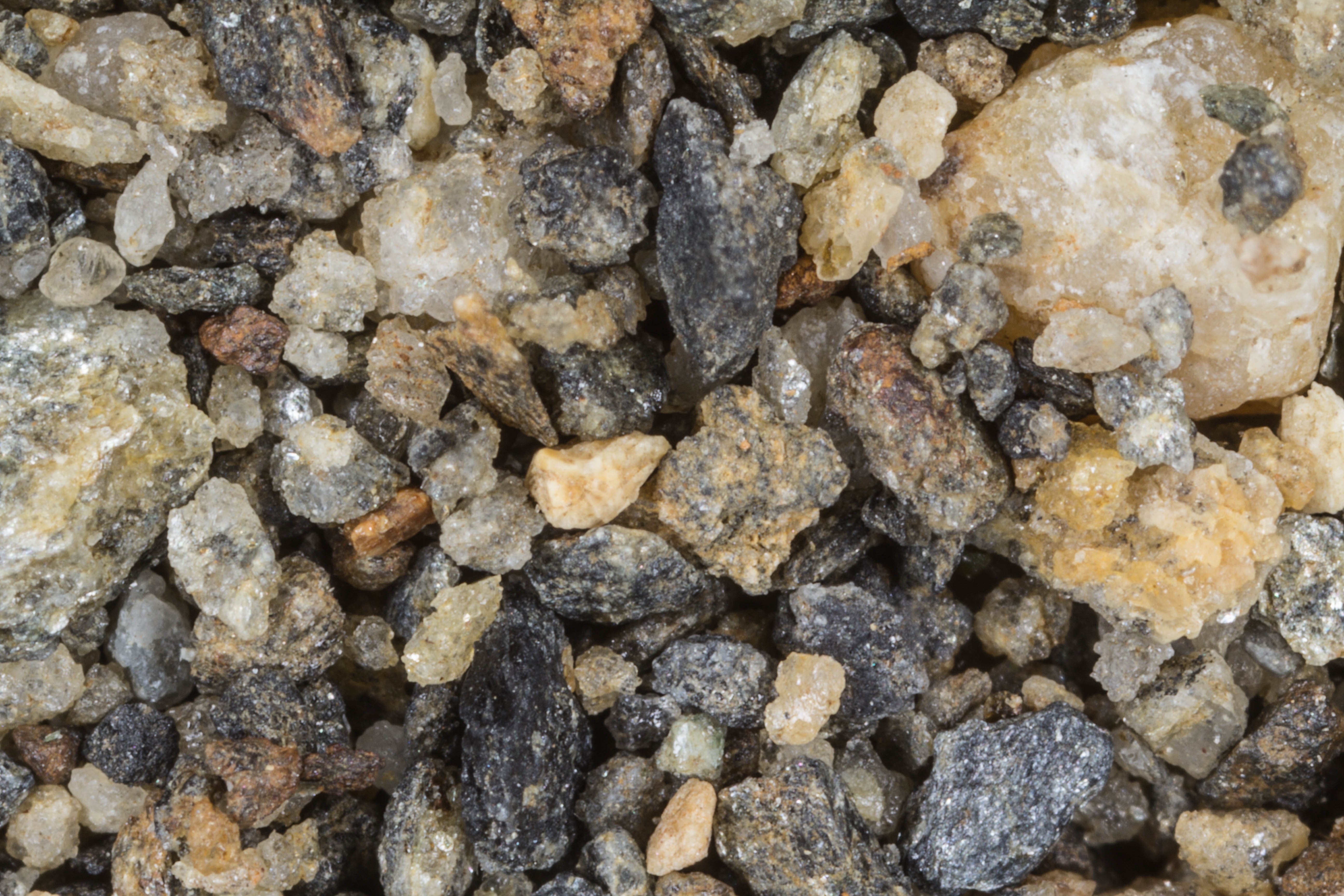
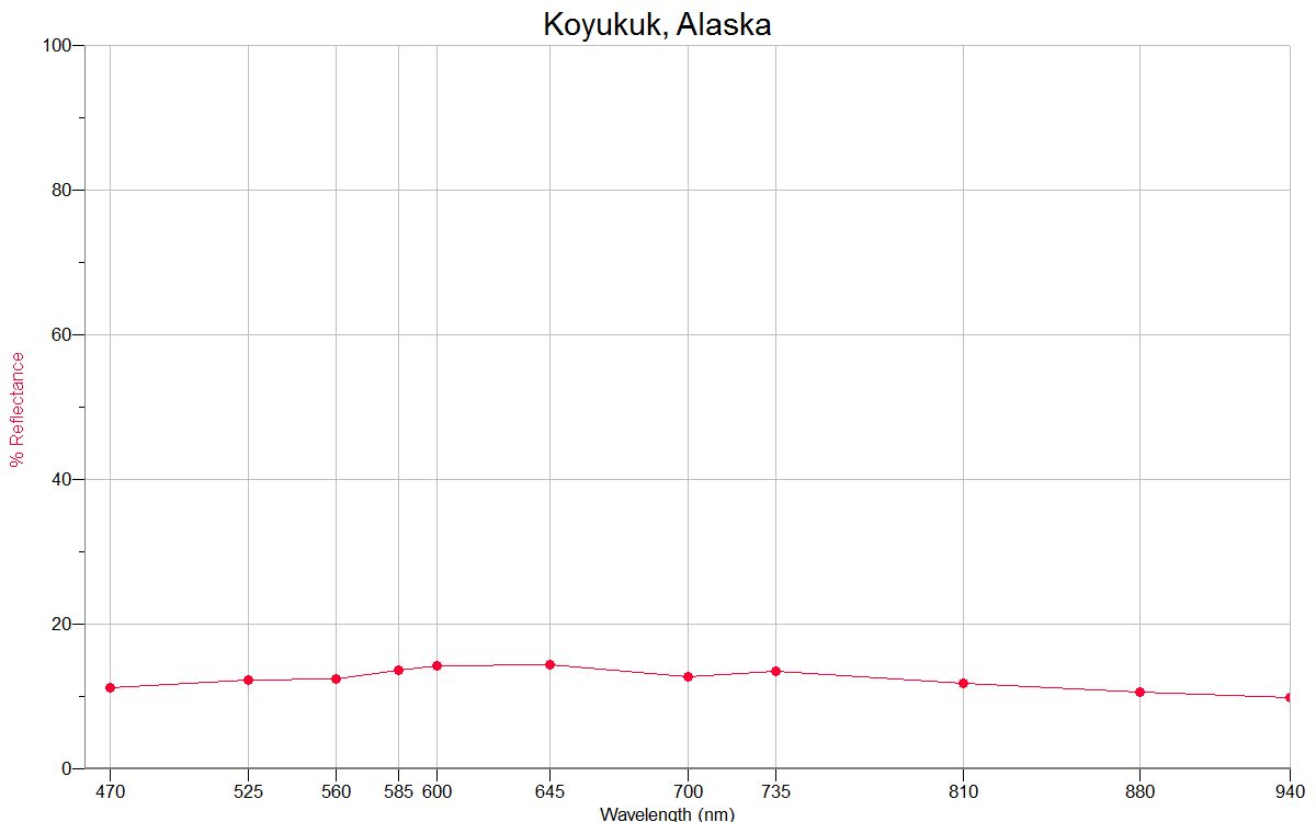
KOYUKUK 64.88N, 157.70W |
 |
 |
|
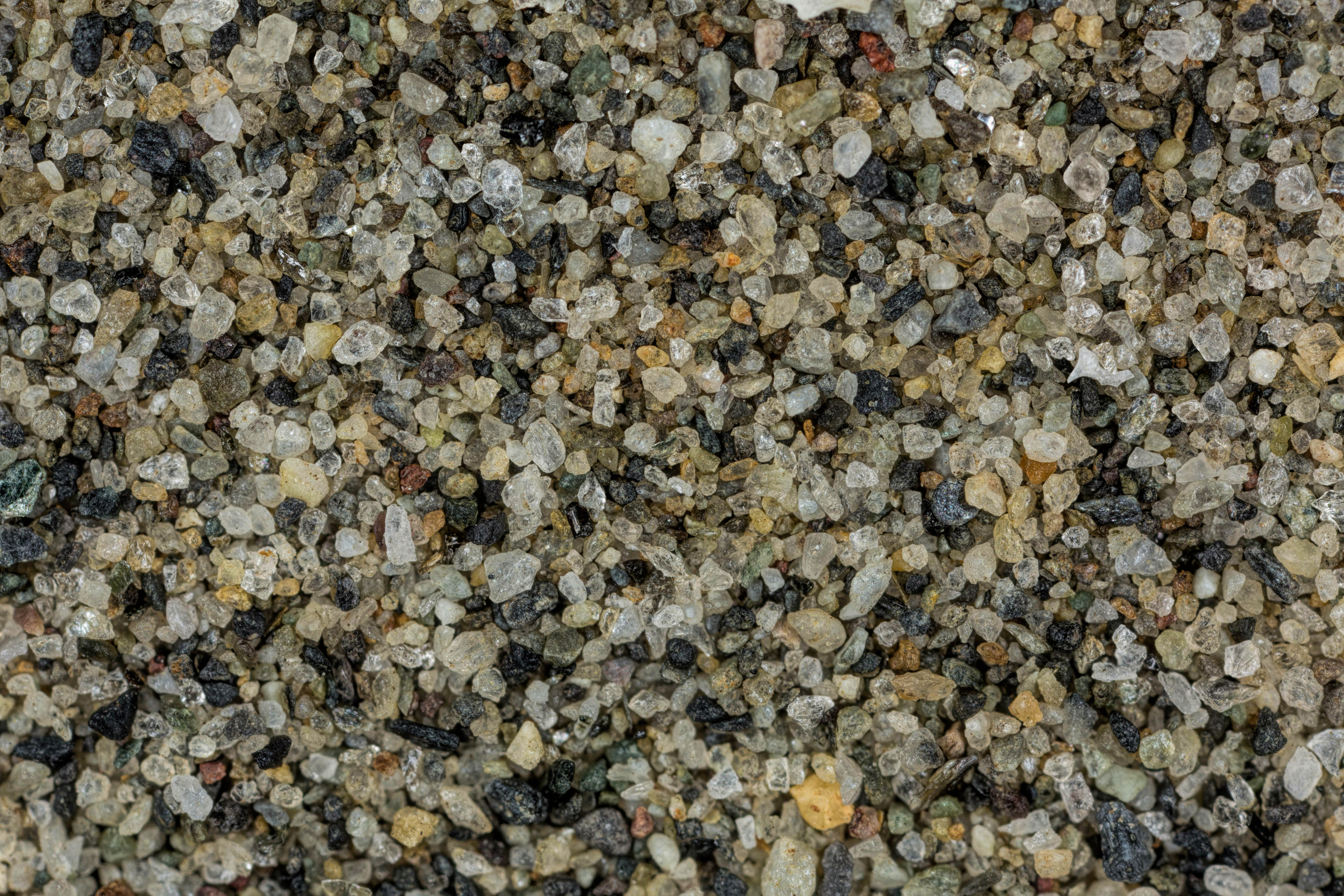
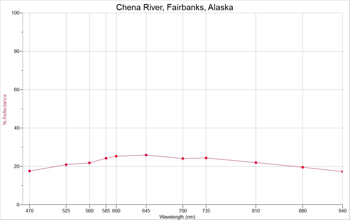
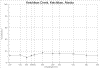
CHENA R.
FAIRBANKS 64.84N, 147.72W
|
 |
 |
|
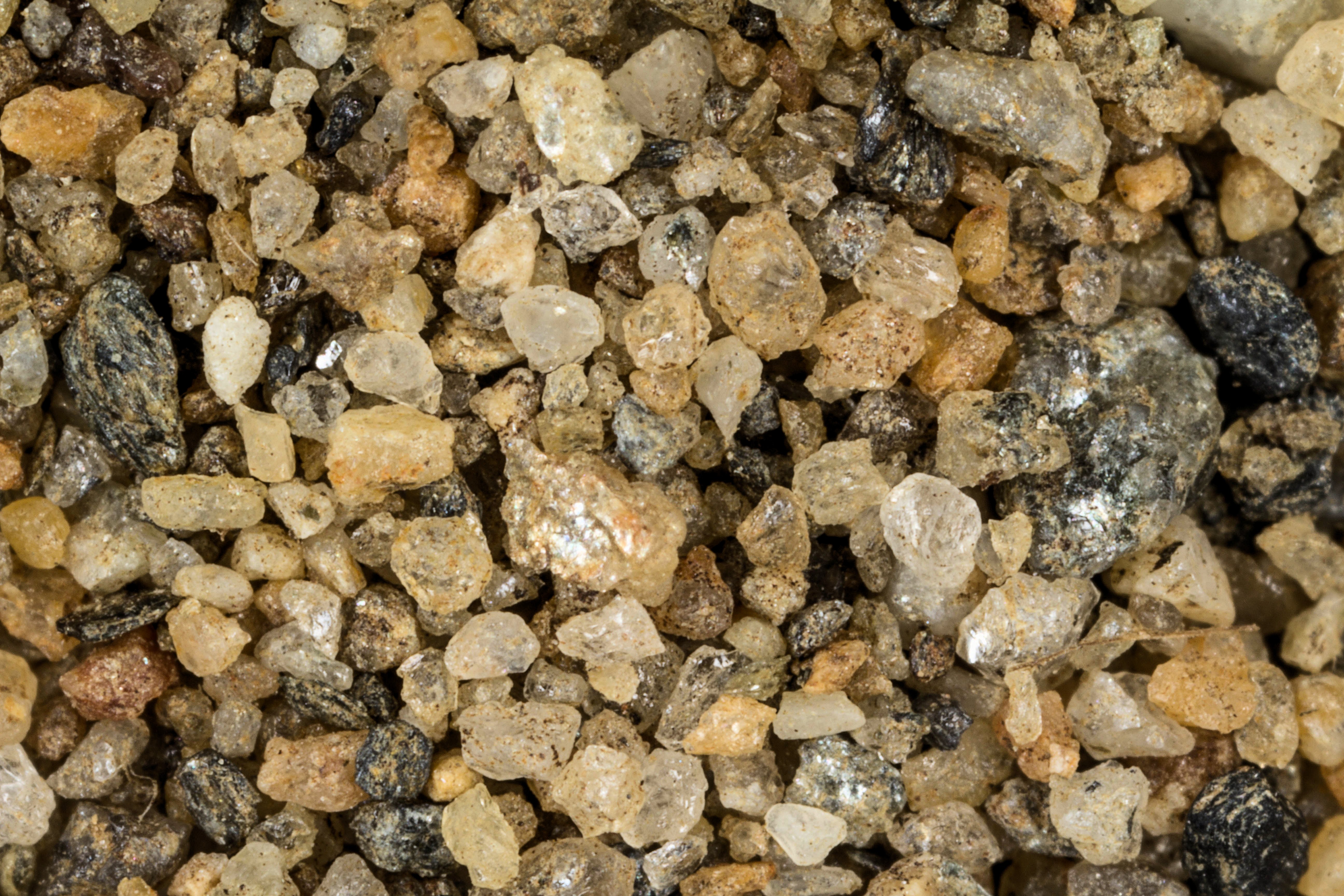
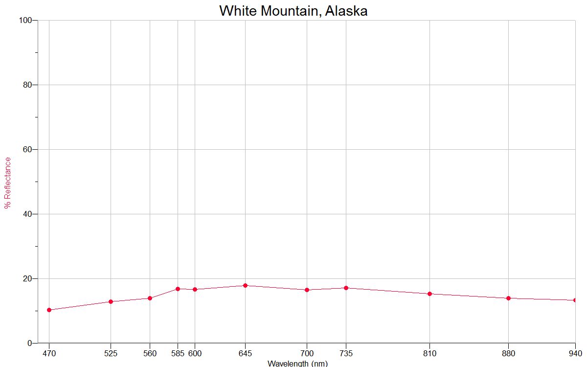
WHITE MOUNTAIN 64.68N, 163.41W |
 |
 |
|
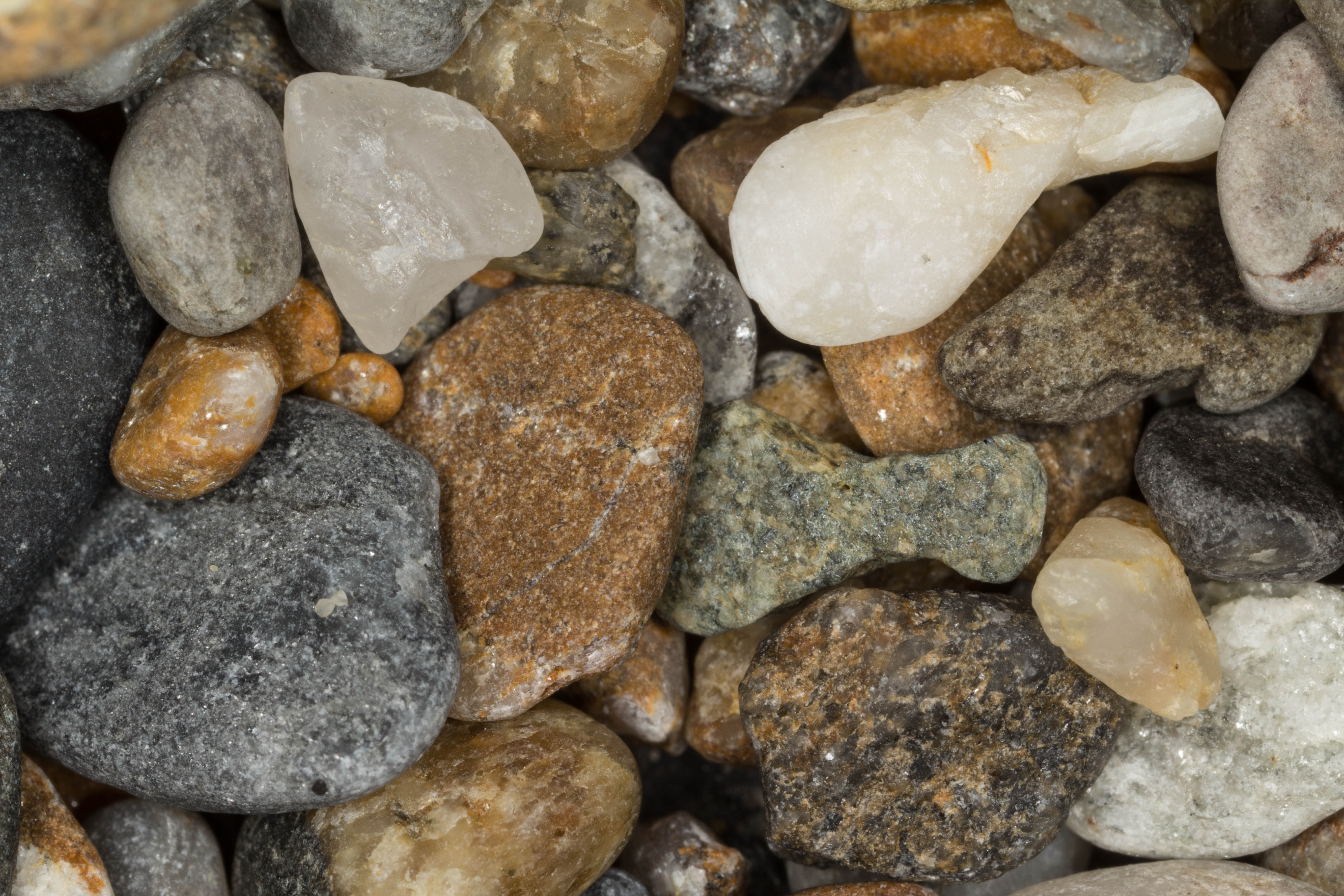
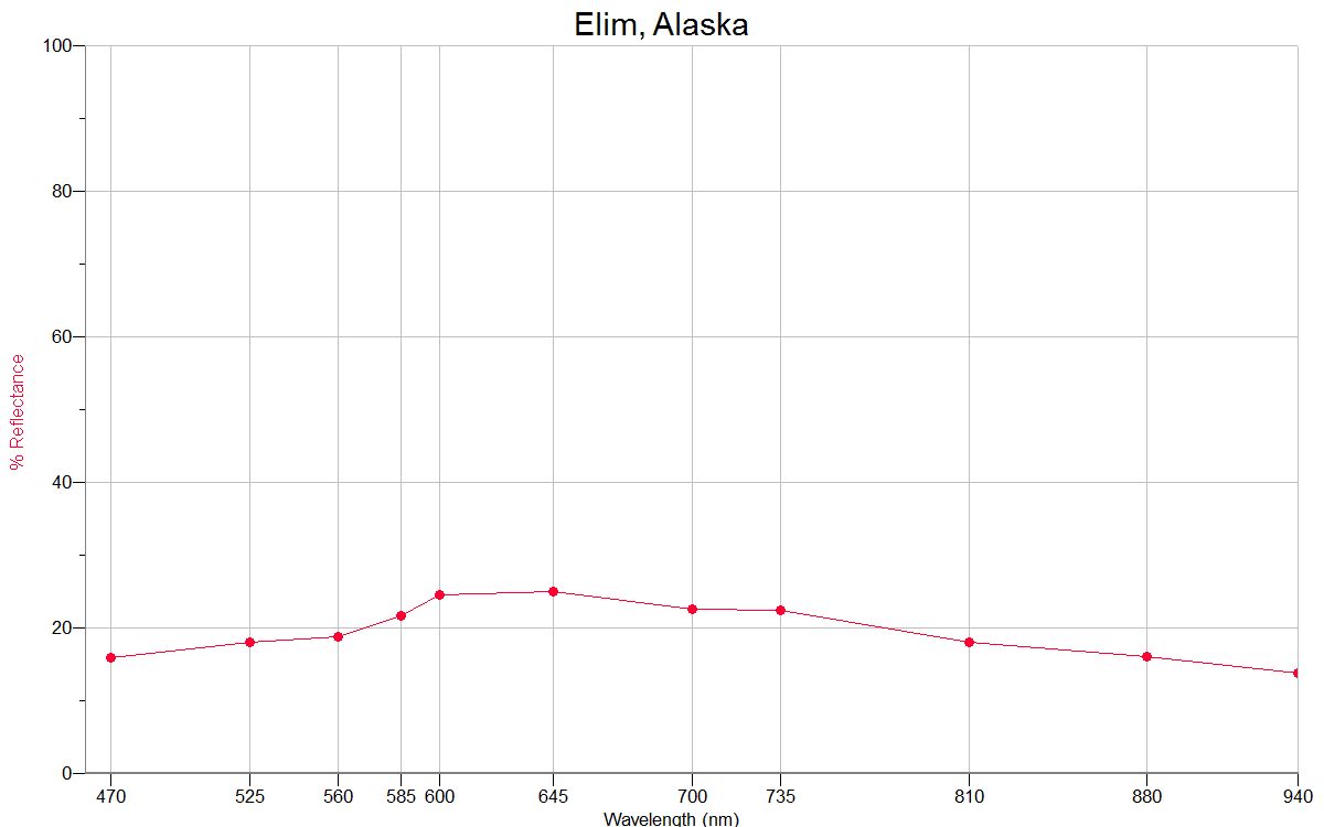
ELIM
64.62N, 162.26W |
 |
 |
|
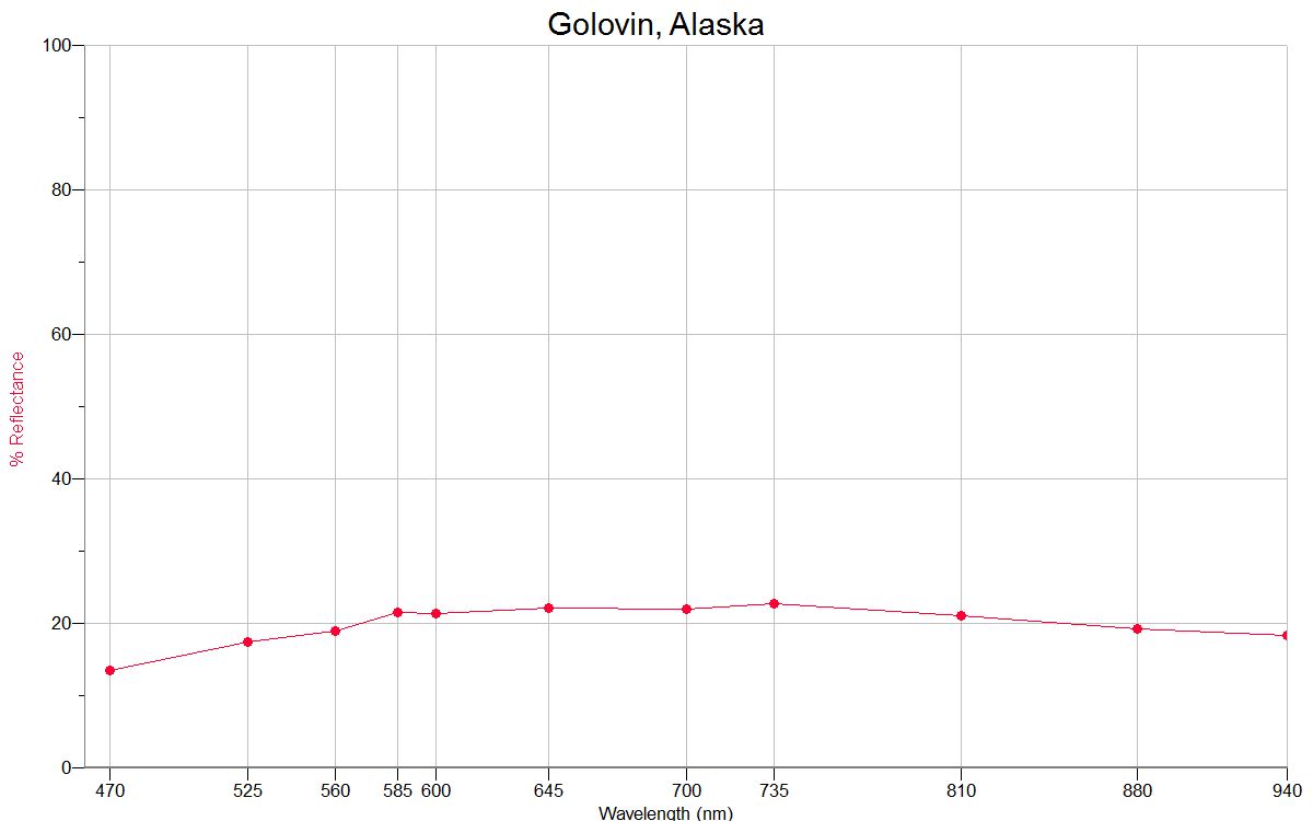
GOLOVIN 64.55N, 163.03W |
 |
 |
|
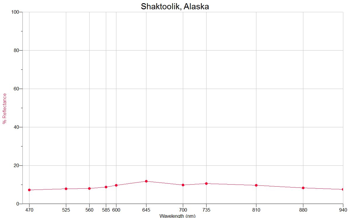
SHAKTOOLIK 64.36N, 161.19W |
 |
 |
|
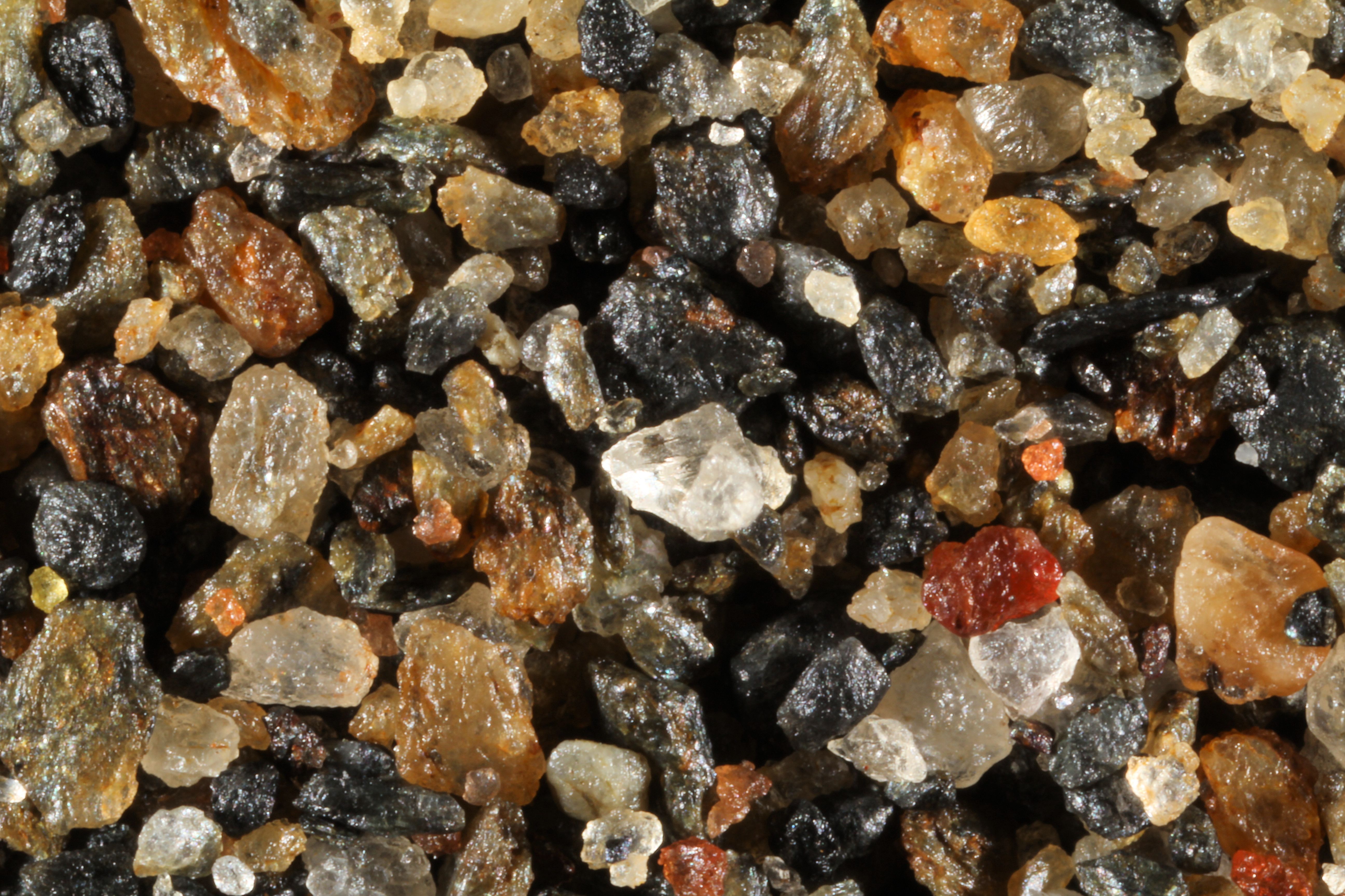
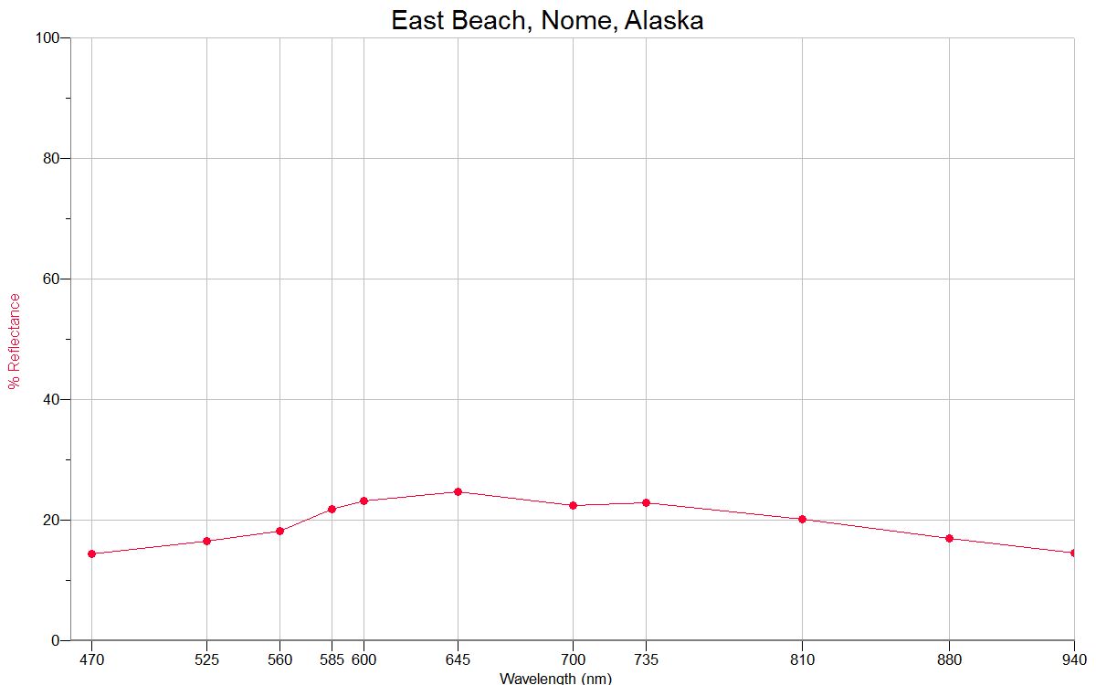
EAST
BEACH, NOME 64.50N, 165.40W |
 |
 |
|
MIDDLE
BEACH, NOME 64.50N, 165.40W |
 |
 |
|
ST. MICHAEL 63.47N, 162.05W
|
 |
 |
|
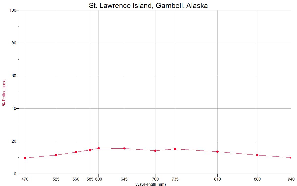
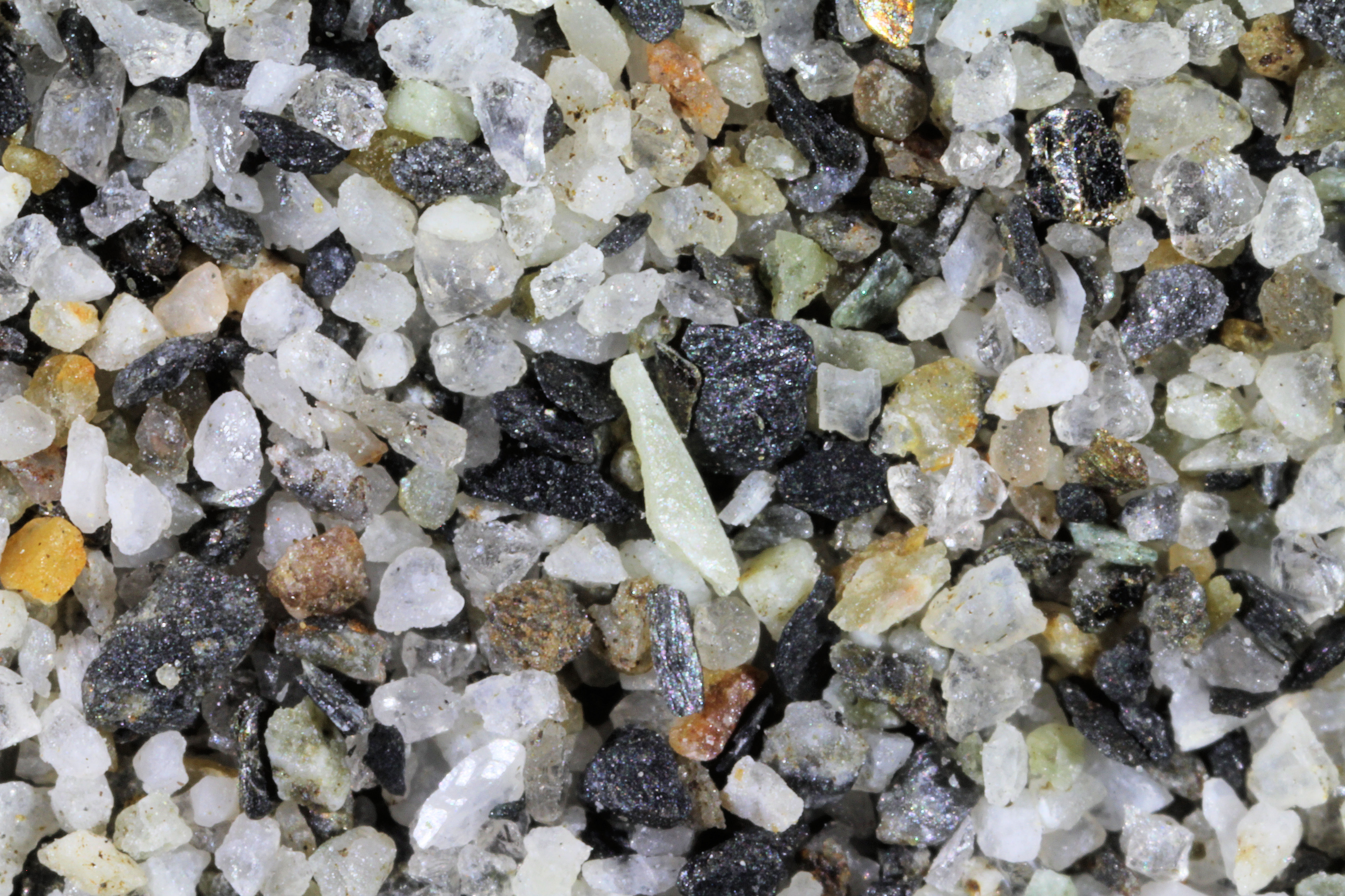
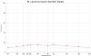
ST. LAWRENCE IS. 63.42N, 170.40W |
 |
 |
|
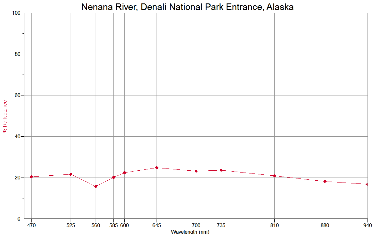
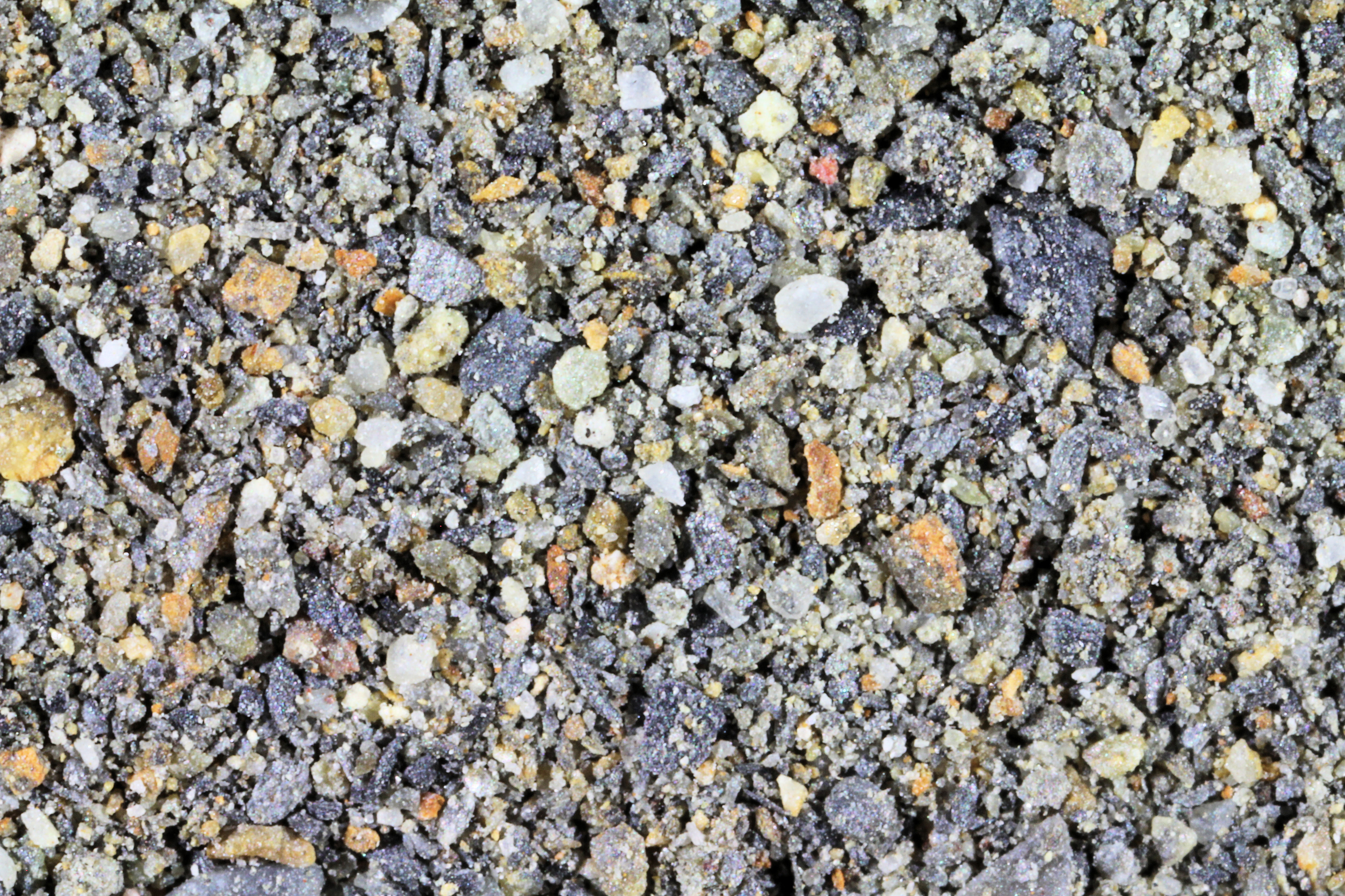
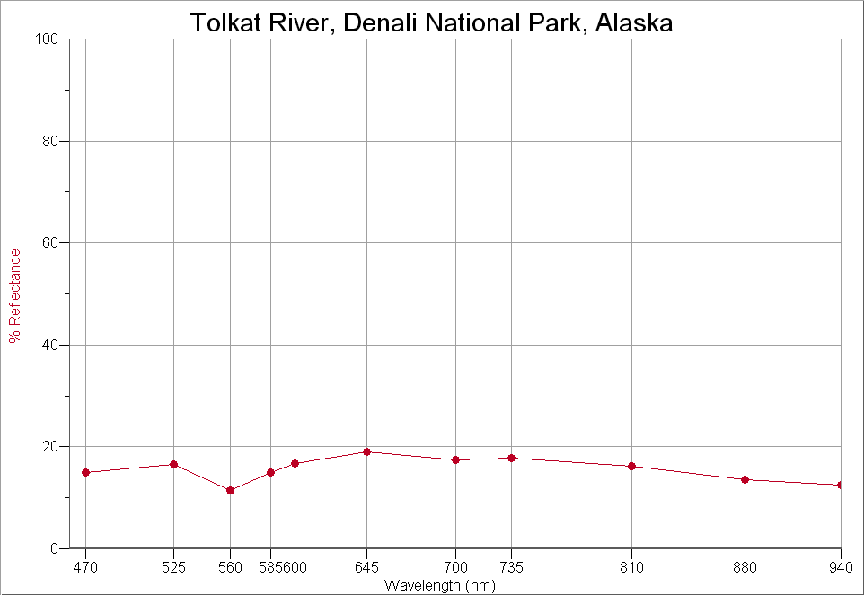
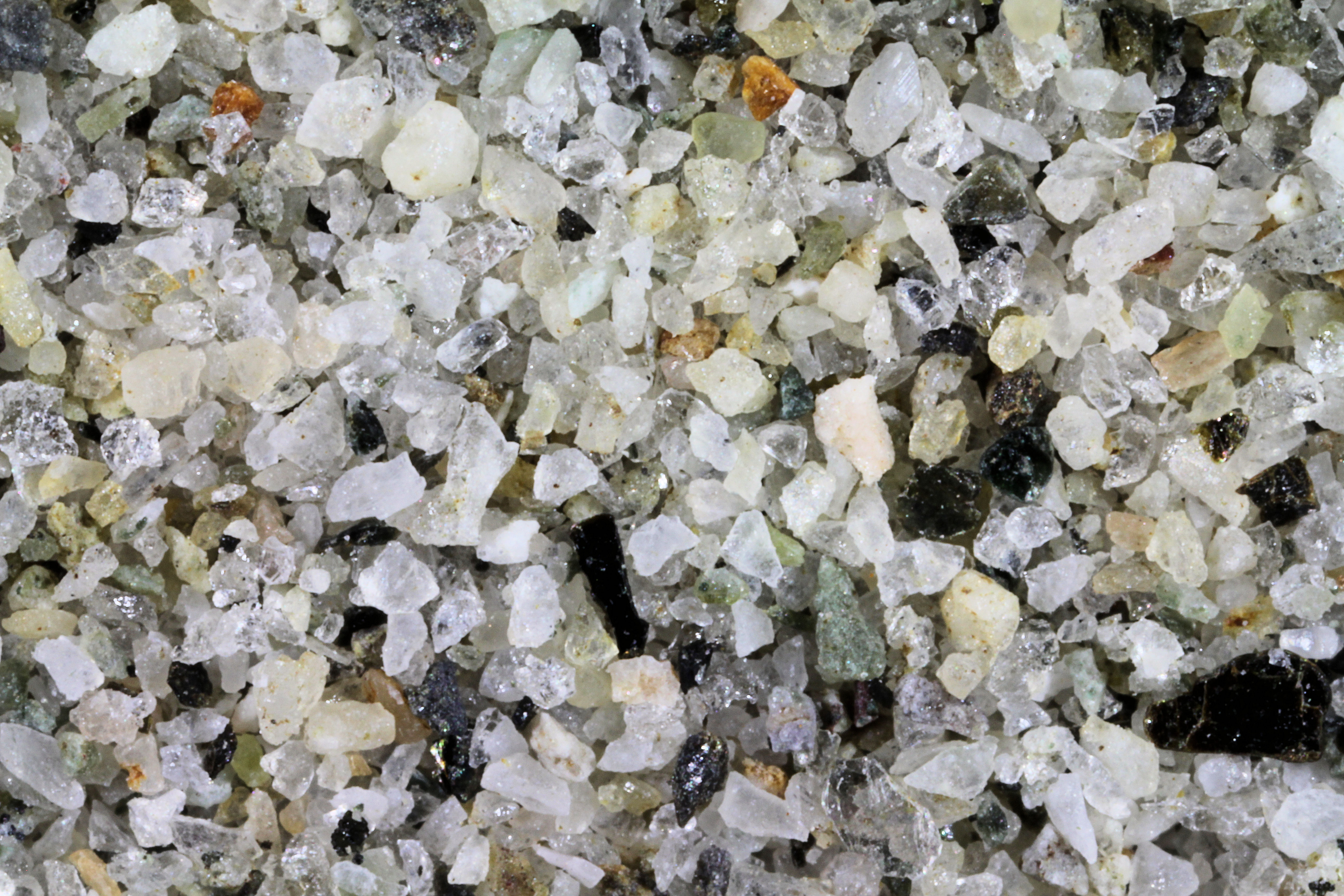
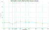
DENALI
NAT. PARK (1) 63.33N, 150.50W |
 |
 |
|
DENALI NATI. PARK
(2) 63.33N, 150.50W |
 |
 |
|
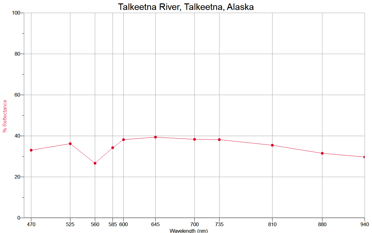
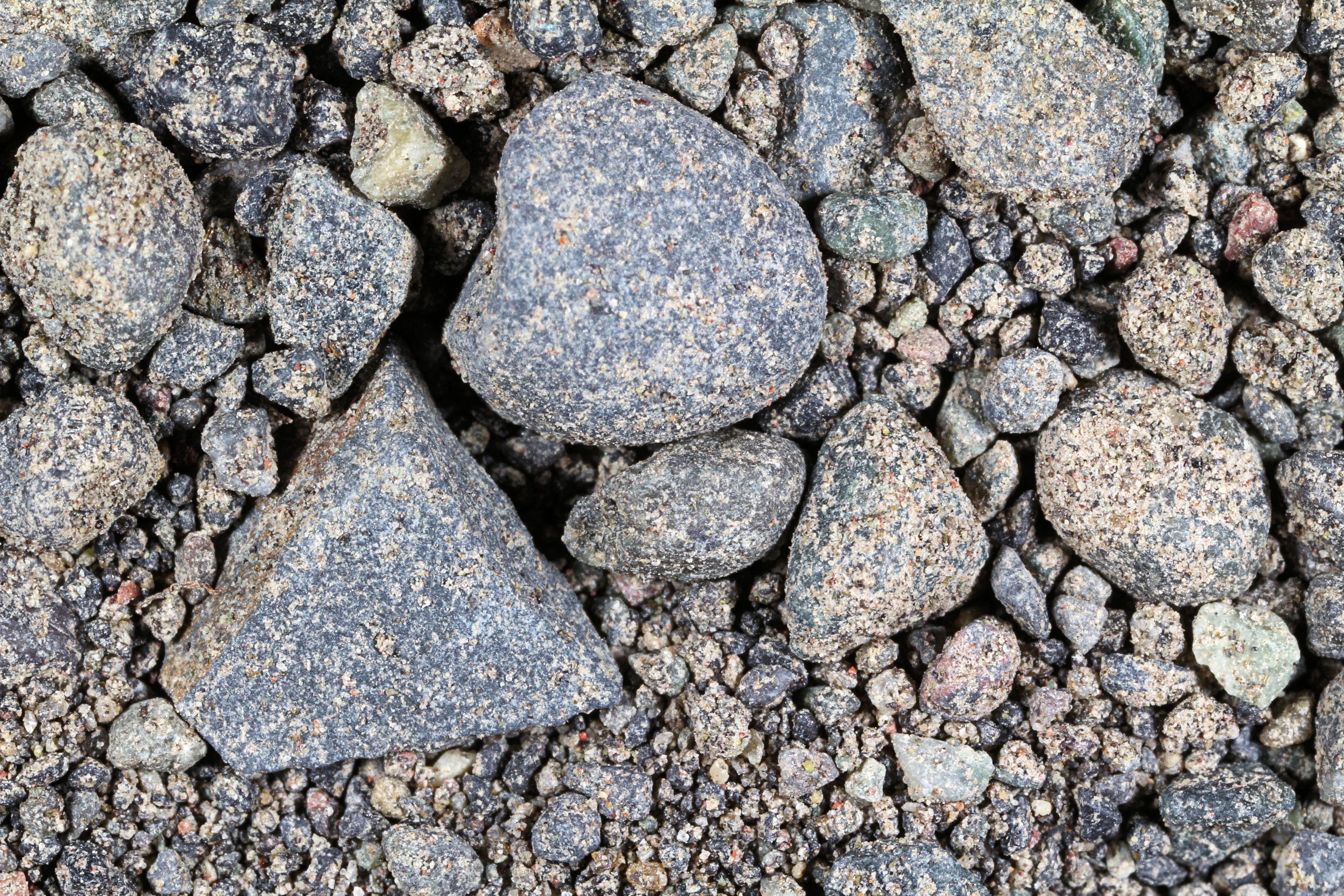
TALKEETNA RIVER, 62.31N,
150.09W |
 |
 |
|
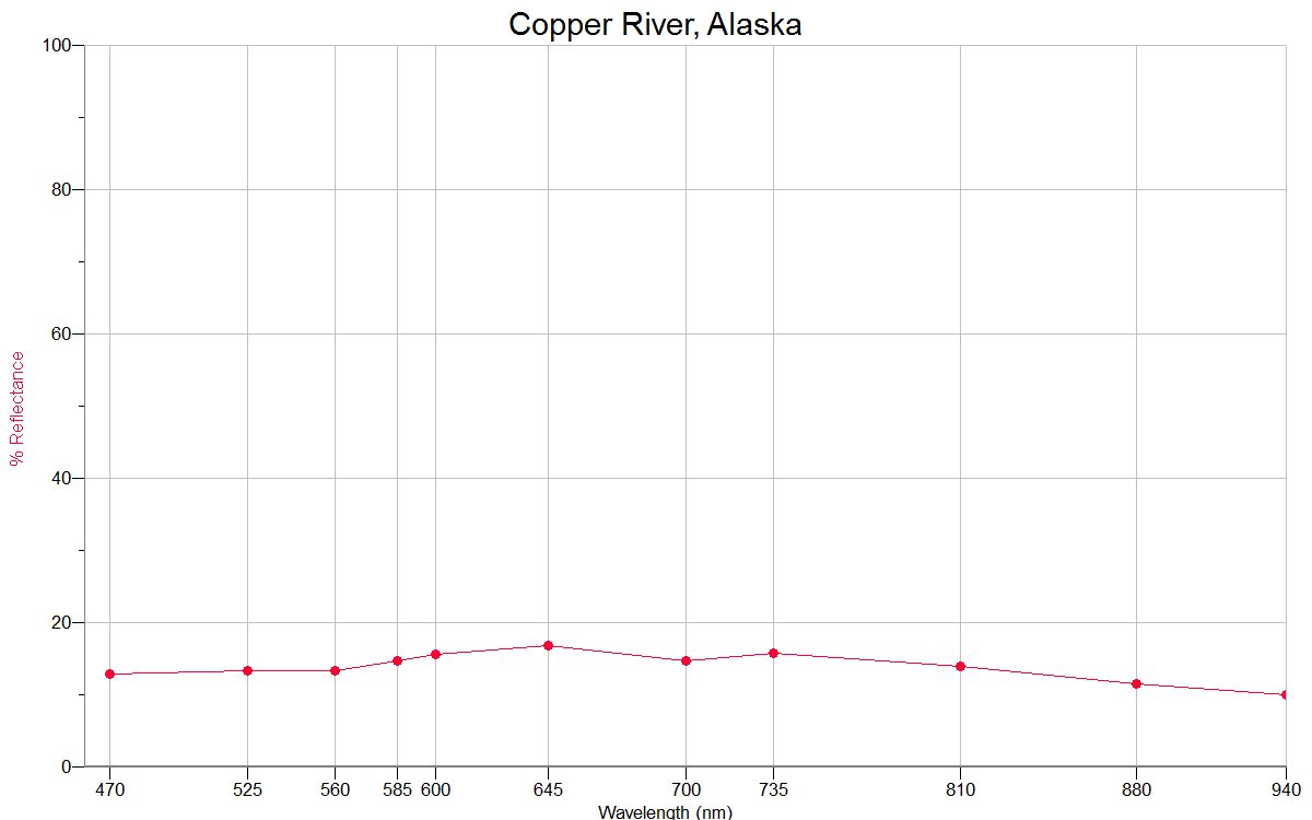
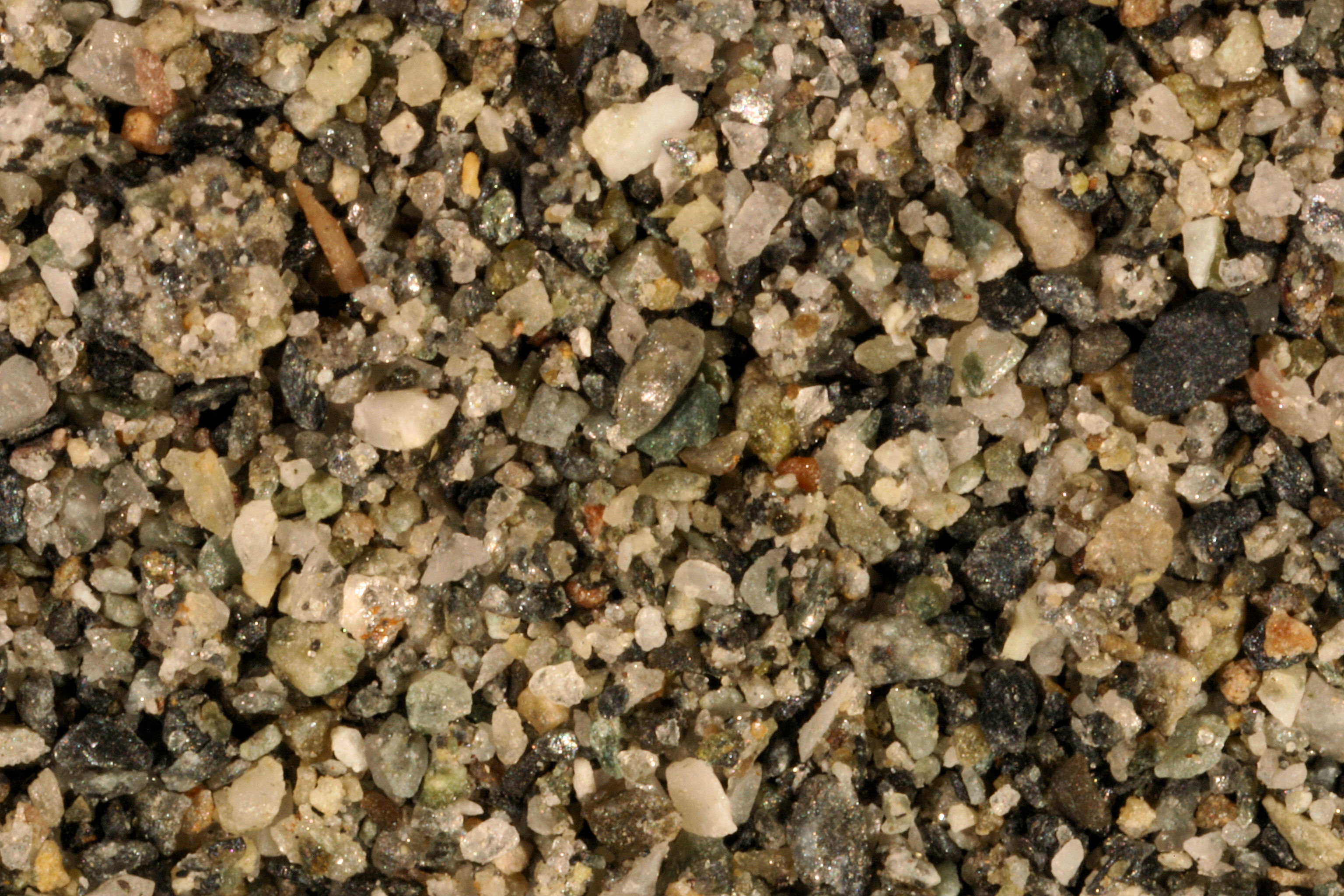
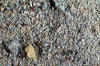
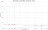
COPPER RIVER ≈62.2N,
≈144.7W |
 |
 |
|
Matanuska R.
Palmer 61.62N, 148.99W |
 |
|
|
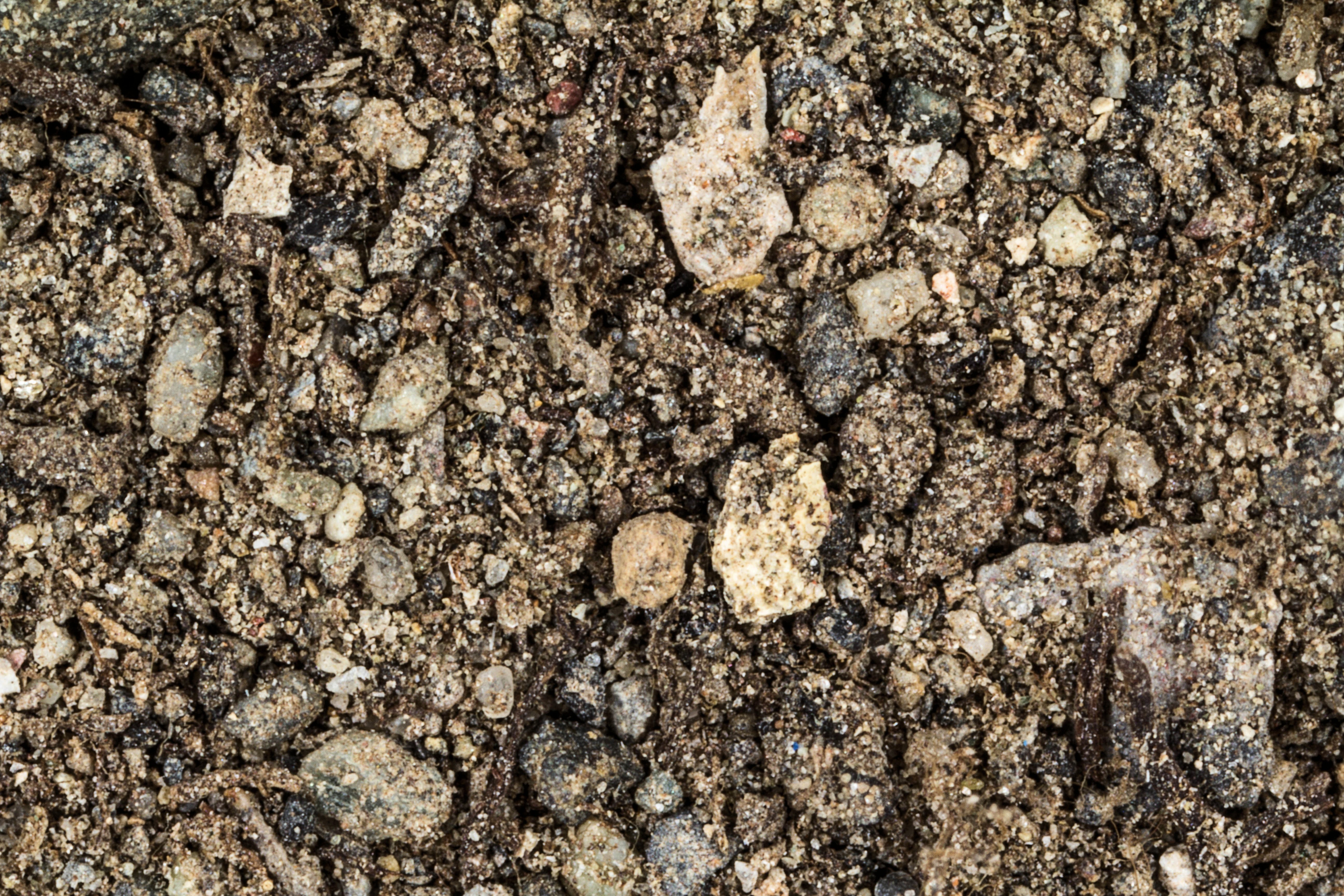
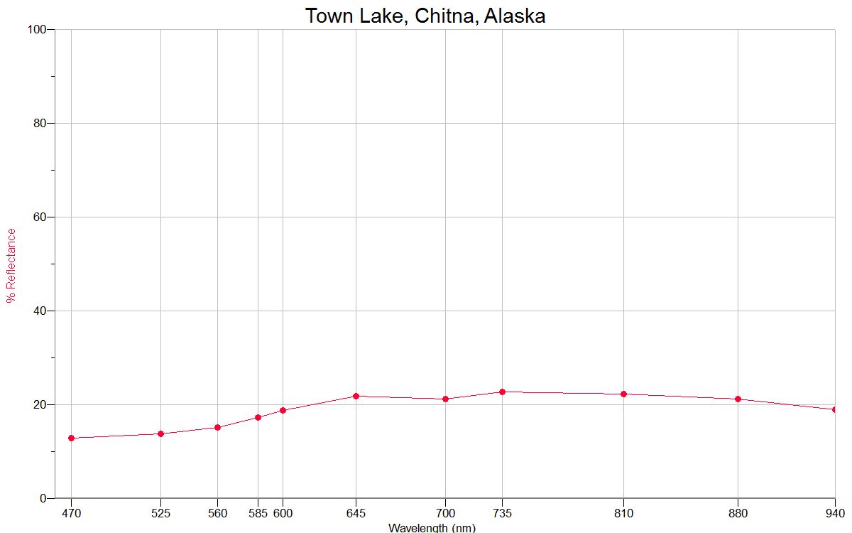
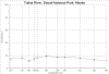
TOWN LAKE, CHITNA 61.54N, 144.43W |
 |
 |
|
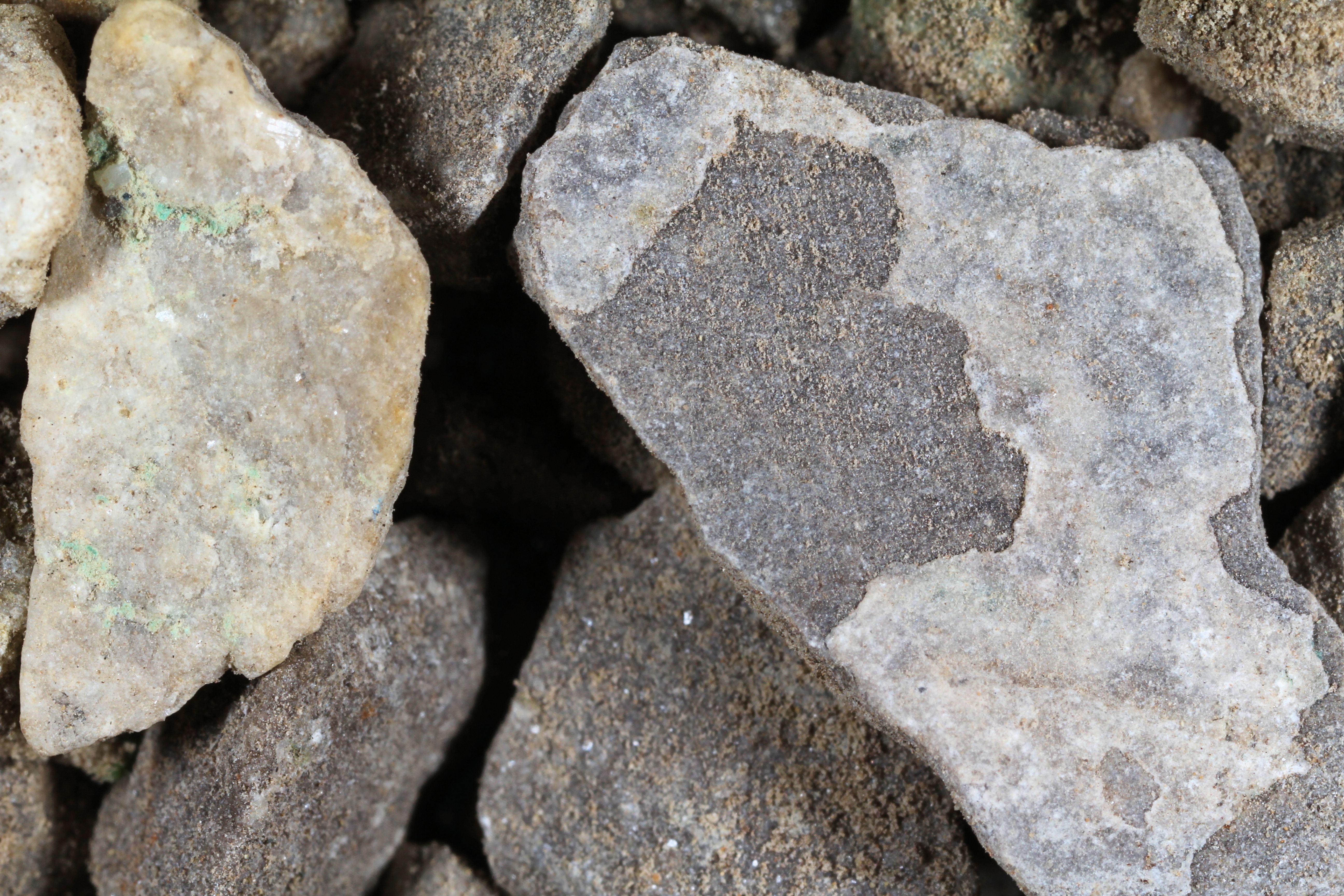
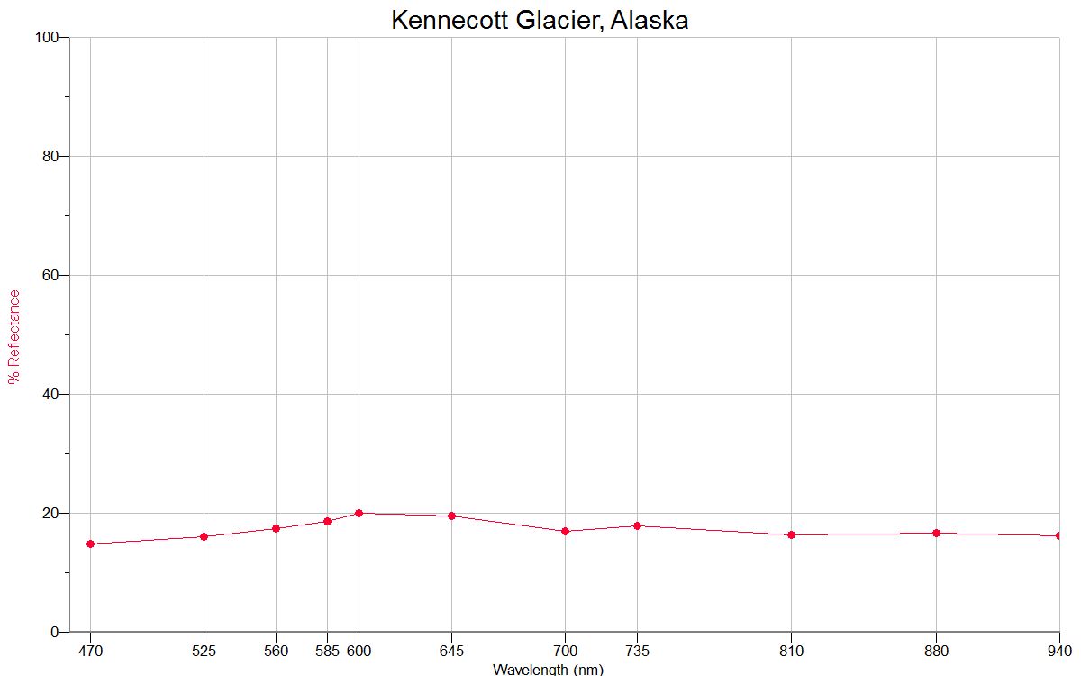
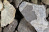
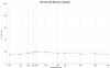
KENNECOTT
61.49N,
142.89W |
|
|
|
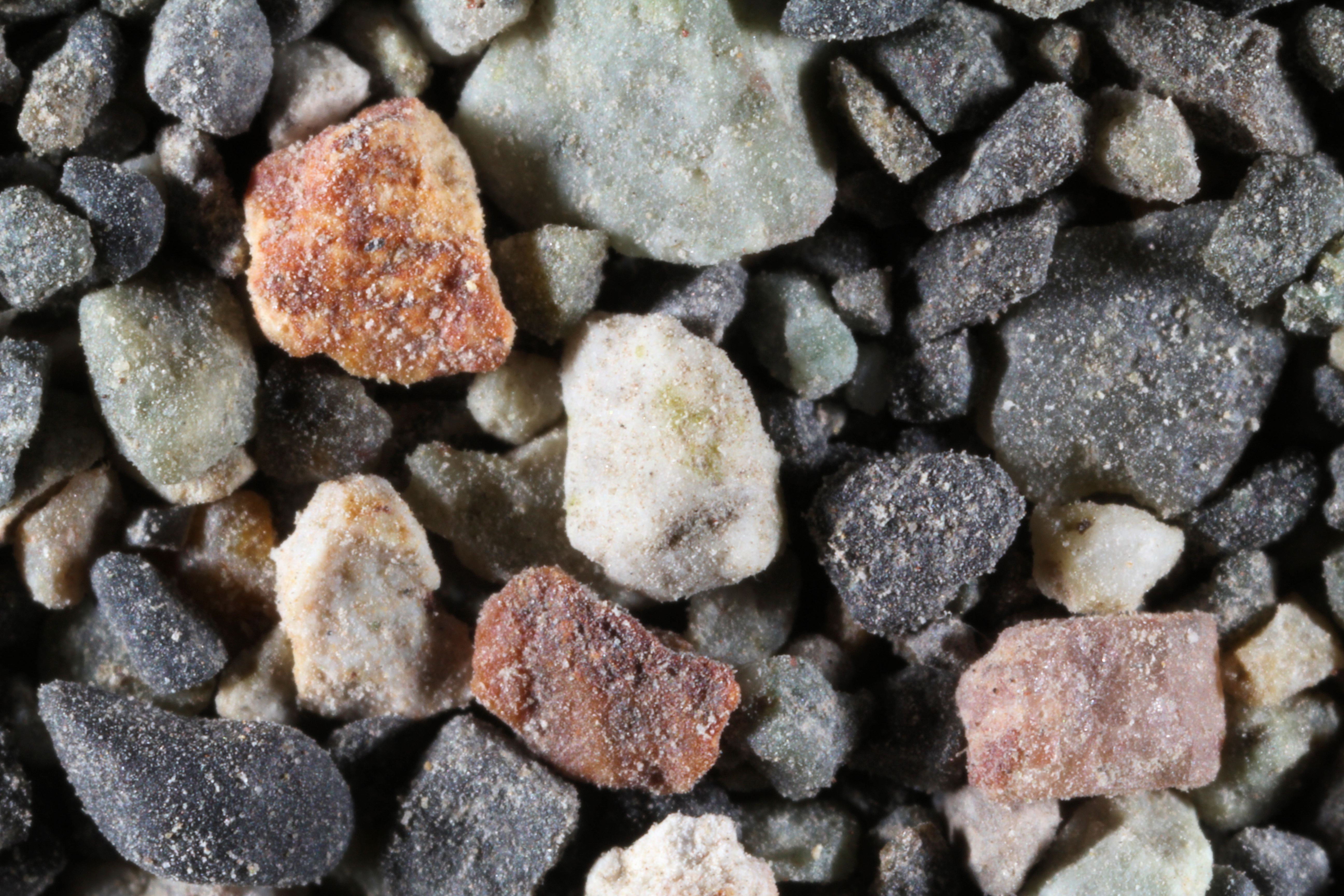
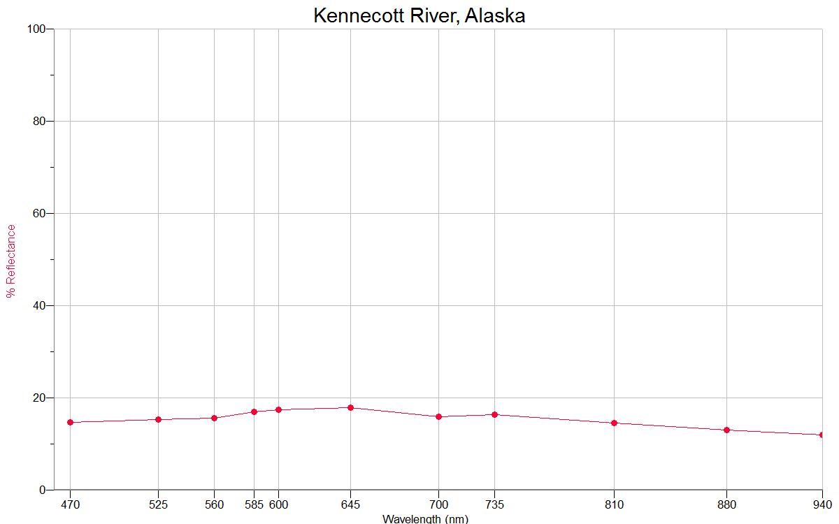
KENNECOTT
RIVER |
 |
 |
|
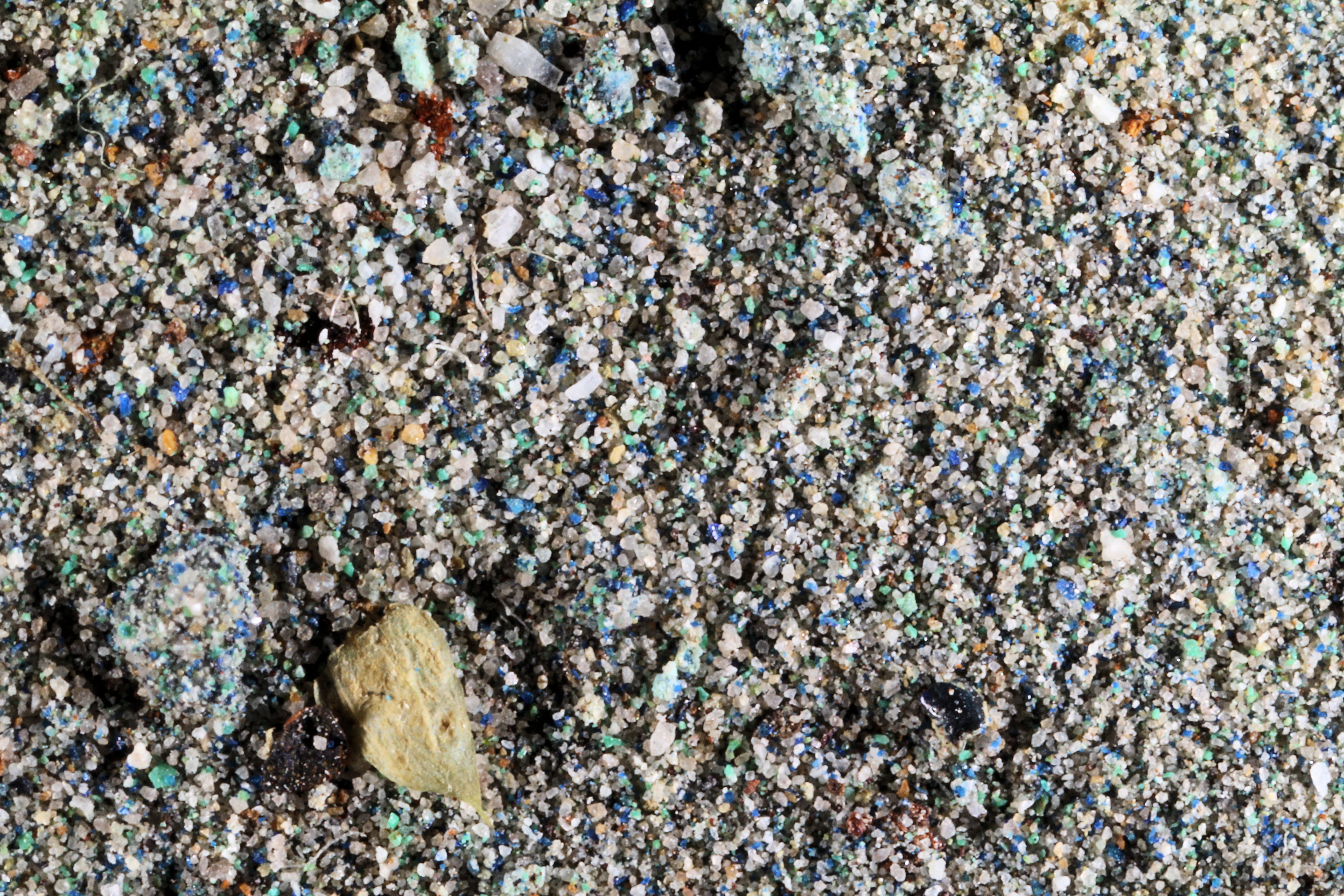
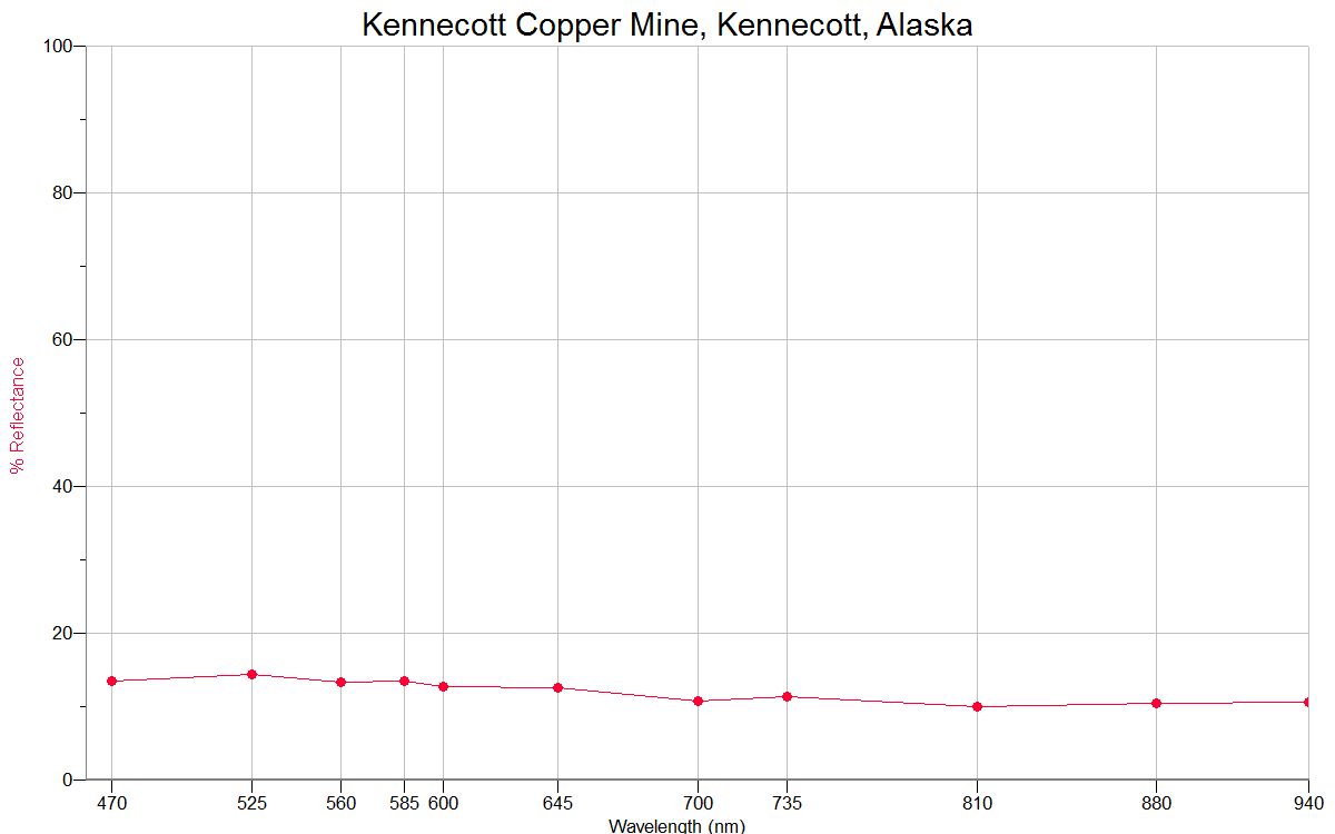
KENNECOTT
MINE |
 |
 |
|
KENNECOTT
GLACIER |
 |
 |
|
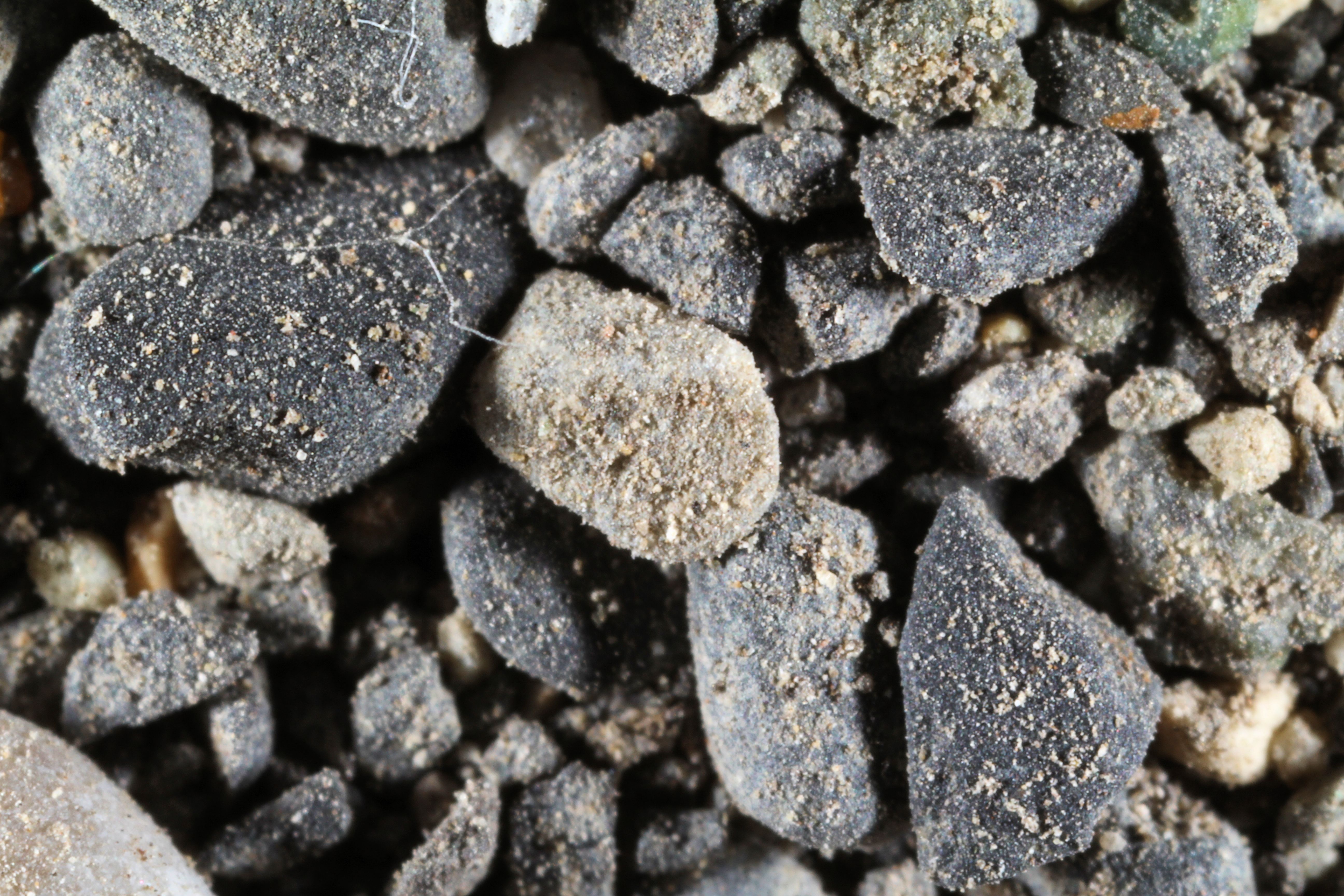
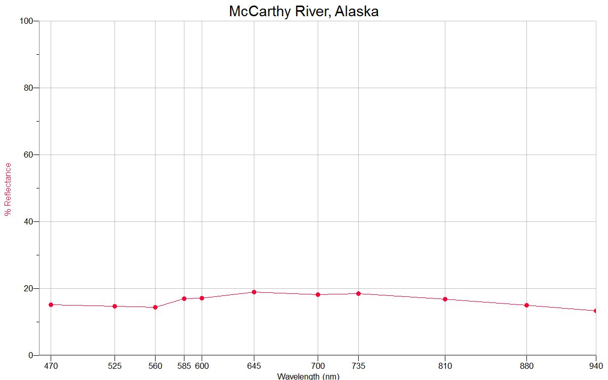
MCCARTHY RIVER
61.43N, 142.91W |
 |
 |
|
Cook Inlet 61.14N,
149.53W |
 |
|
|
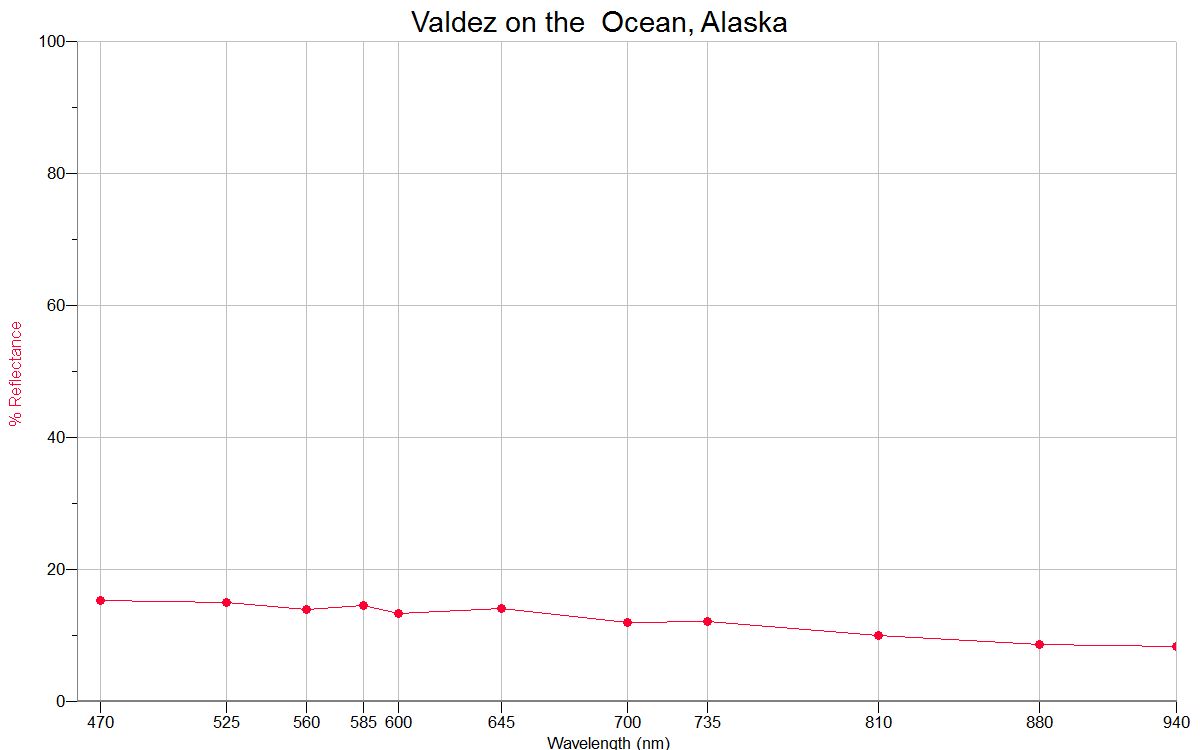
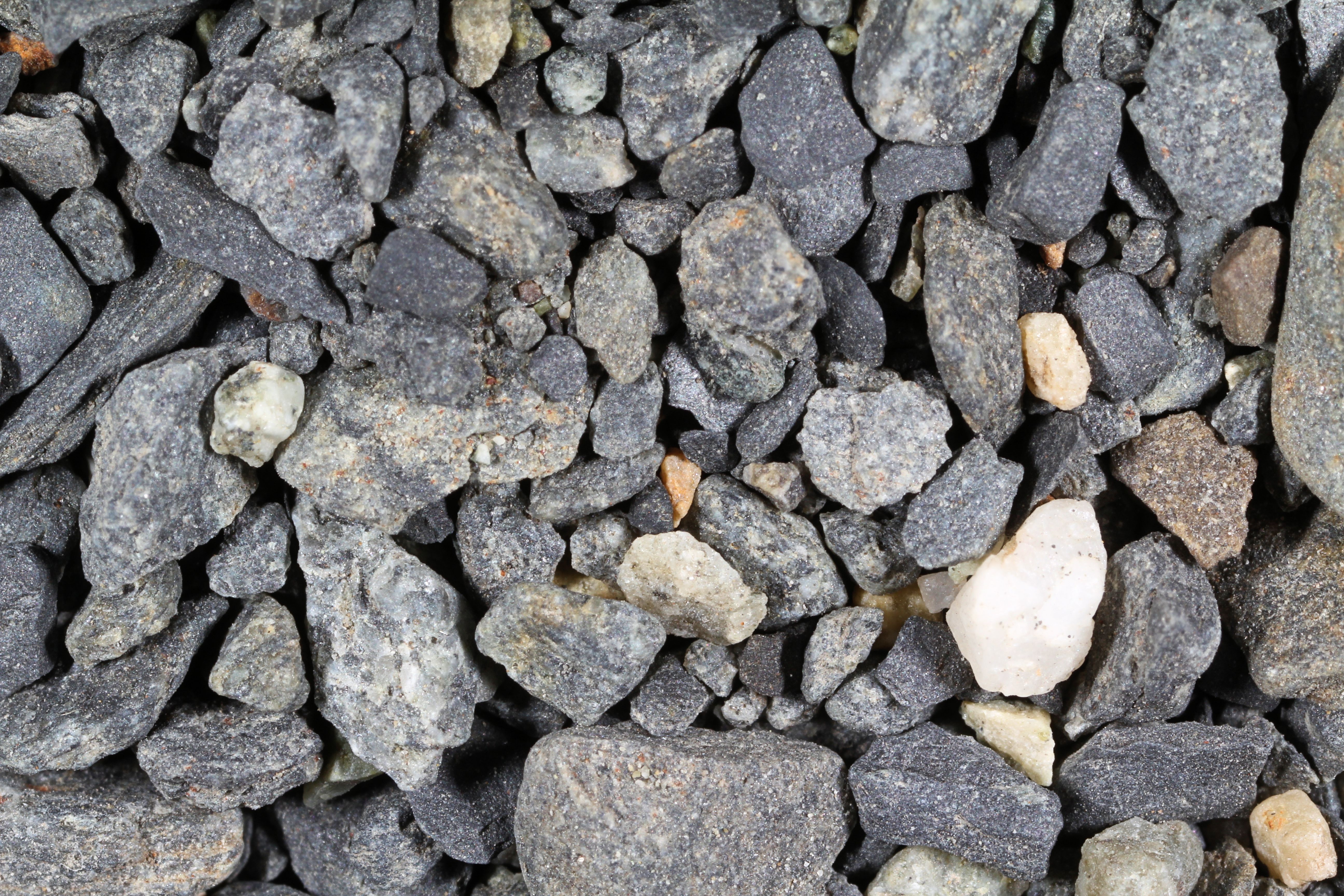
VALDEZ (1X)
61.13N, 146.35W |
 |
 |
|
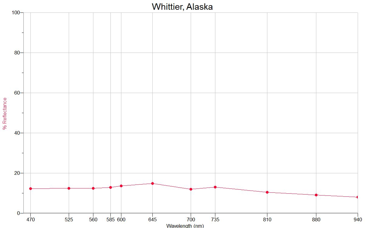
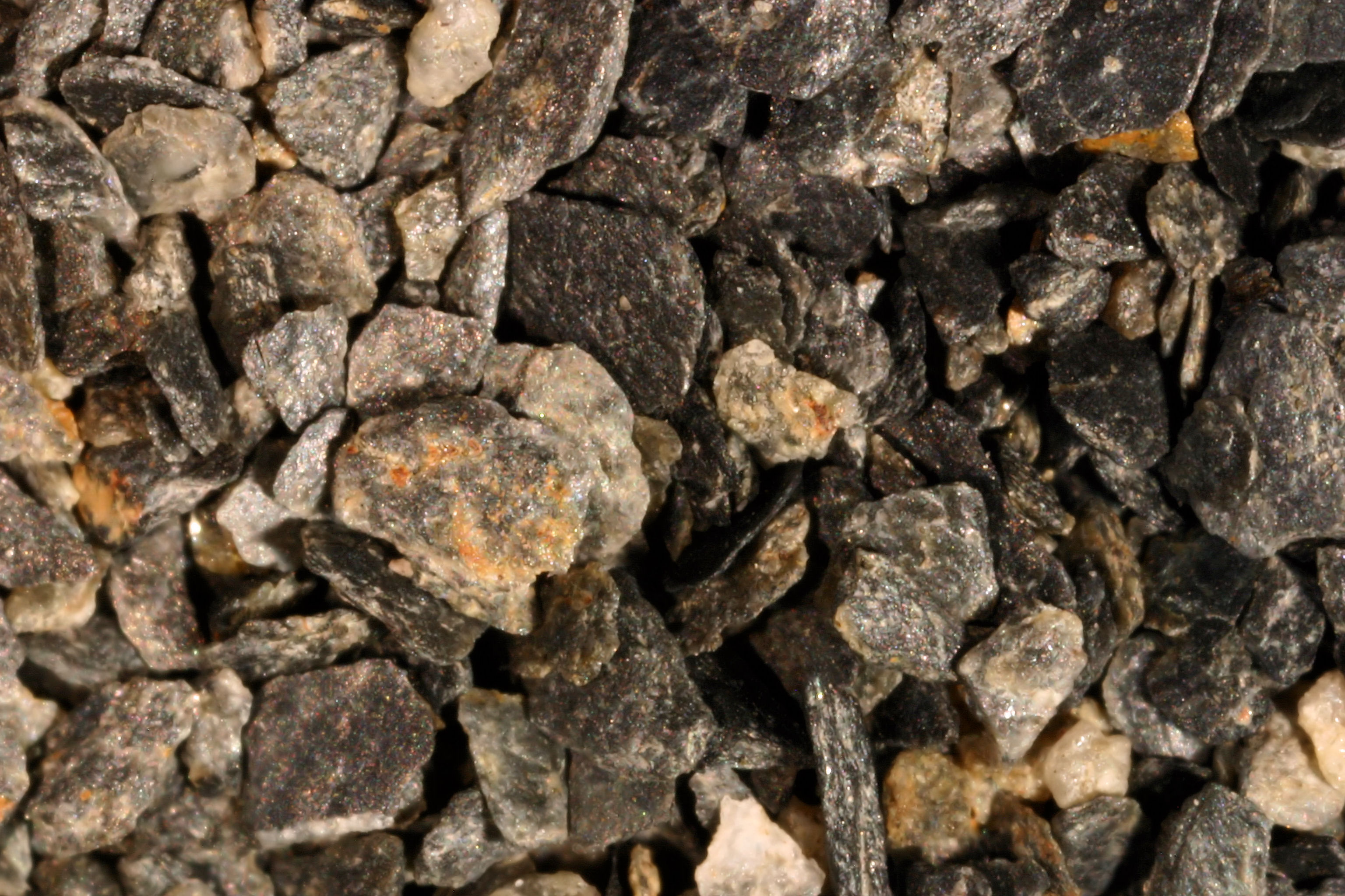
WHITTIER
60.77N, 148.68W |
 |
 |
|
COOPER LANDING
60.49N, 149.79W |
 |
|
|
Ptarmigan Creek
nr. Muskwa Village 60.40N, 149.36W |
 |
|
|
Homer 59.64N,
151.55W |
 |
|
|
SKAGWAY 59.46N, 135.31W
|
 |
|
|
Kachemak Bay,
Homer 59.35N, 151.24W |
 |
|
|
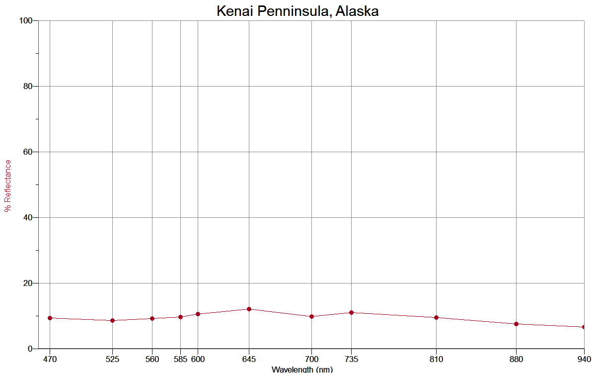
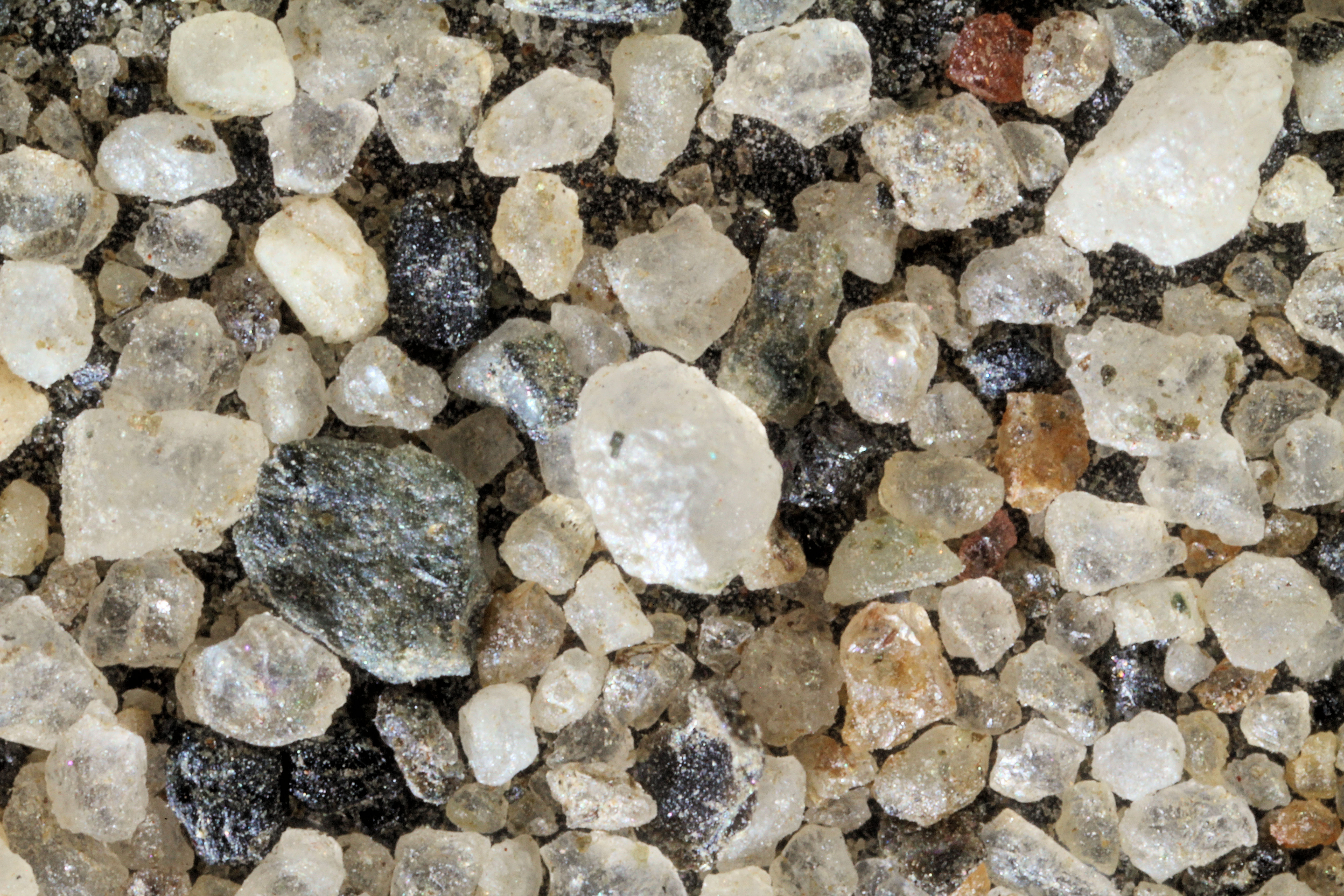
KENAI PENNINSULA,
≈59.00N,
≈151.00W |
 |
|
|
KENAI PENNINSULA(2),
≈59.00N,
≈151.00W |
 |
 |
|
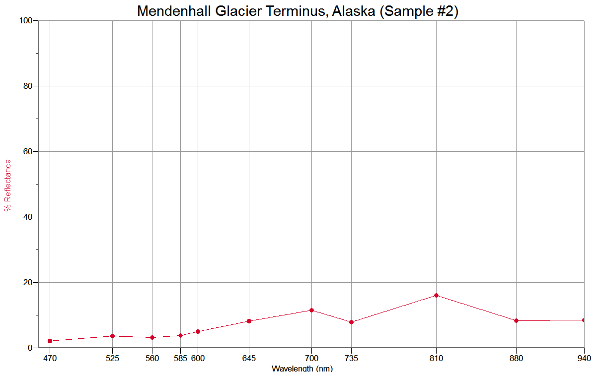
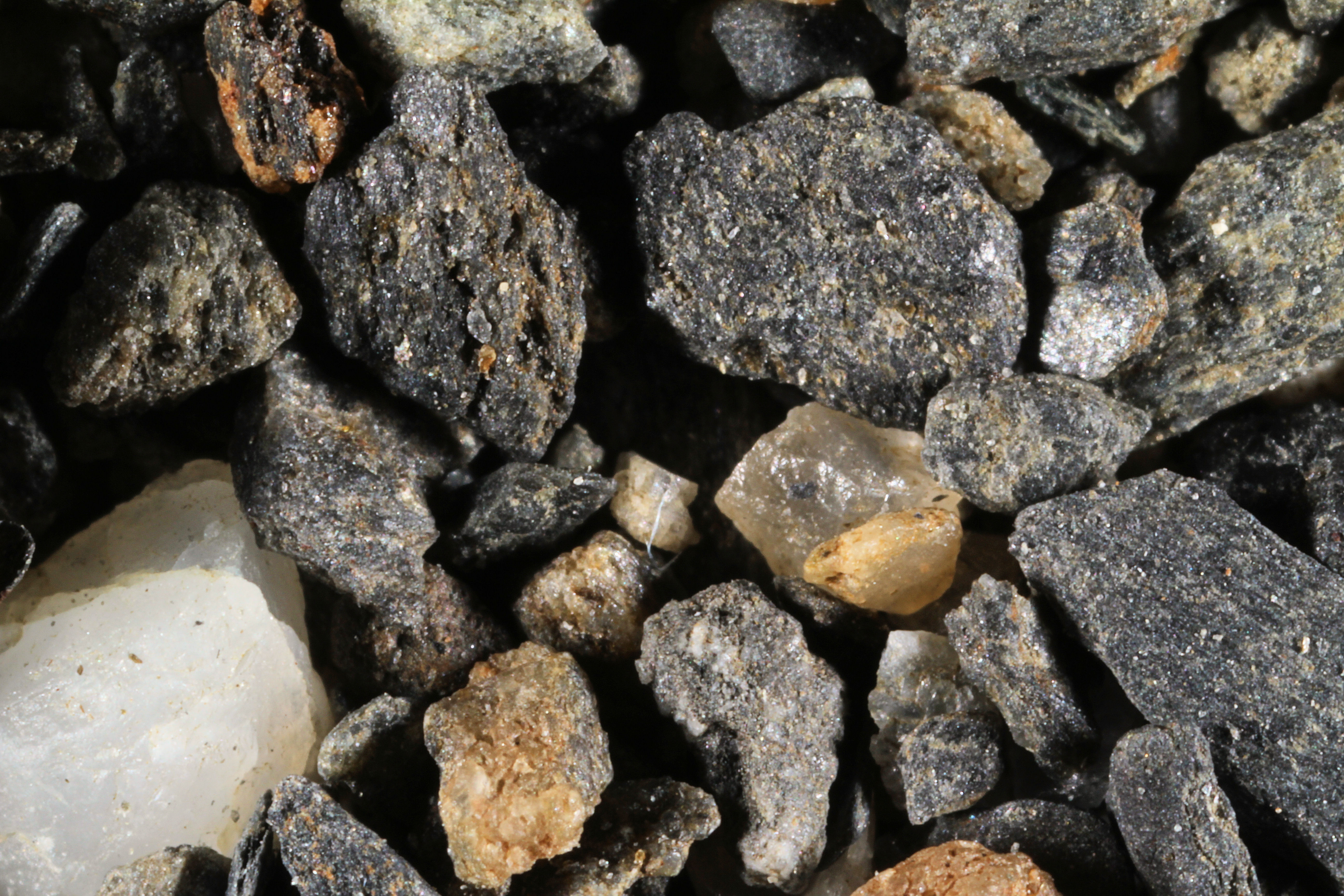
MENDENHALL
GLACIER TERMINUS 58.36N, 134.52 W |
 |
|
|
MENDENHALL
GLACIER TERMINUS (2) 58.36N, 134.52 W |
 |
 |
|
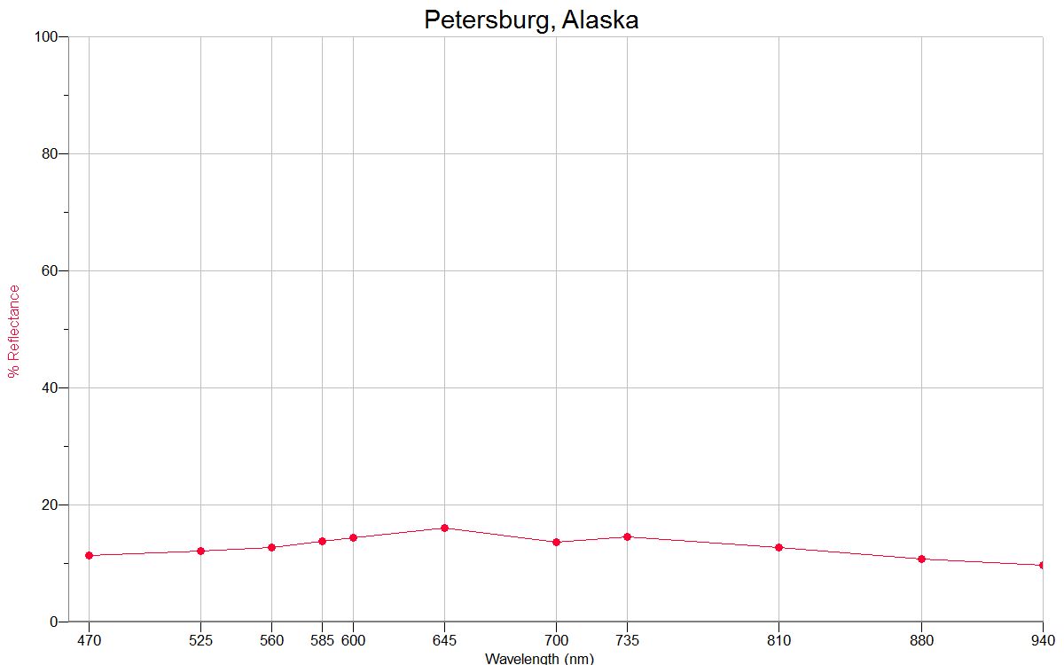
PETERSBURG 56.80N, 132.94W |
 |
 |
|
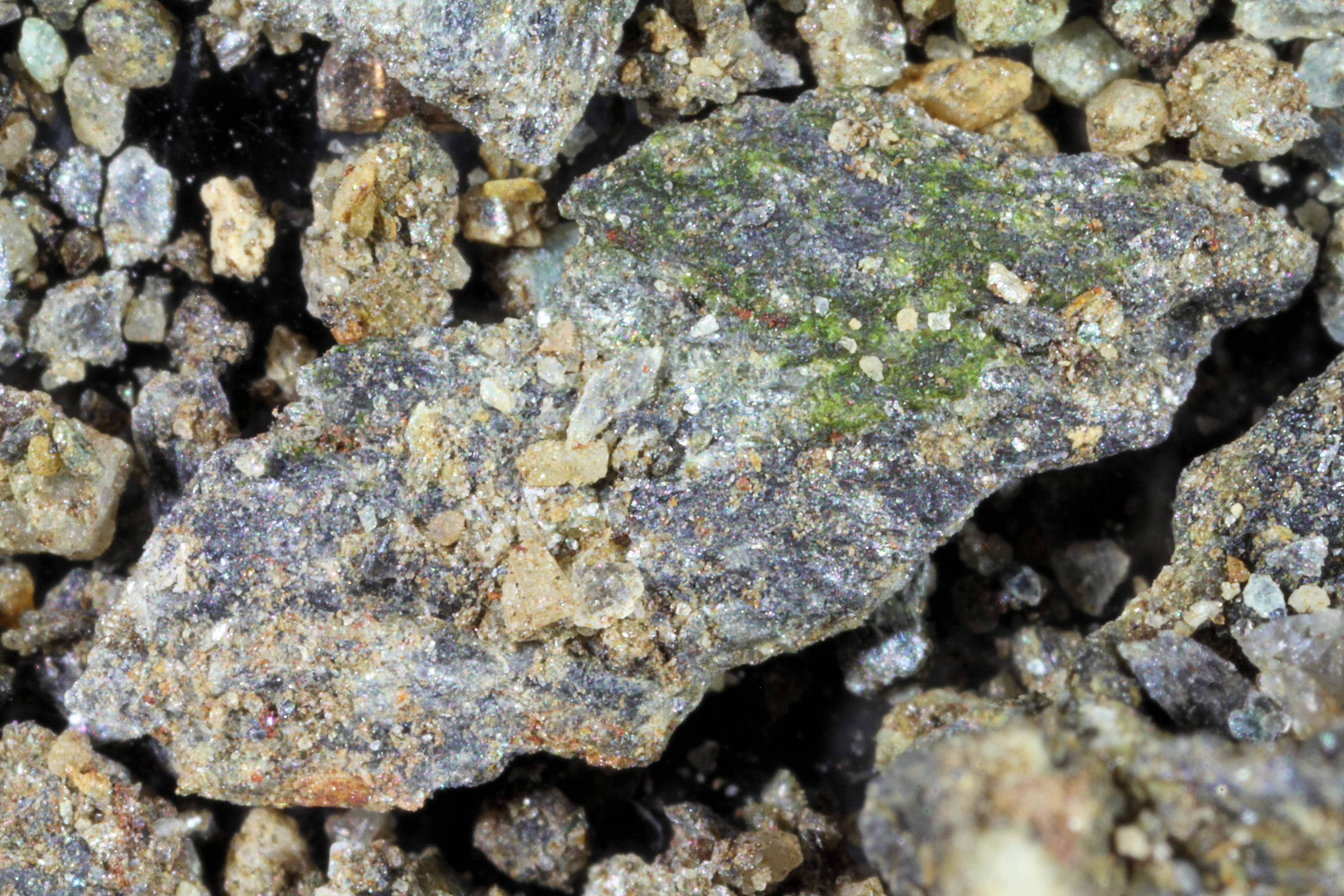
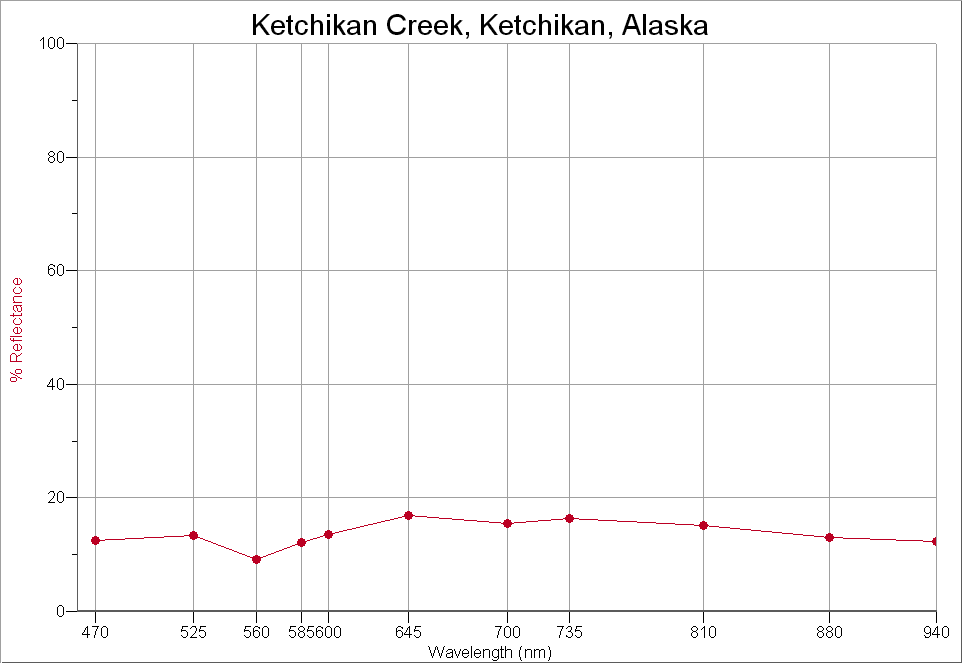
KETCHIKAN CREEK, KETCHIKAN 55.35N, 131.67W |
 |
 |