|
WEST
LOCATION |
THUMBNAIL IMAGE |
THUMBNAIL
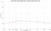
SPECTRA |
EAST
LOCATION |
THUMBNAIL IMAGE |
THUMBNAIL
SPECTRA |
|
|
|
|
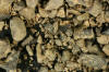
INGRAM ESKER, PLATTSBURGH 44.70N,
73.46W |
 |
 |
|
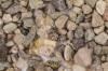
HAMLIN BEACH ST Pk(2 SAMPLES) 43.36N, 77.95W |
 |
 |
|
|
|
|
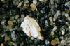
HAMLIN BEACH ST PK (2 SAMPLES) 43.36N, 77.95W |
 |
 |
|
|
|
|
PINNACLE HILL
MORAINE, ROCHESTER, ≈43.19N,
≈77.62W |
 |
 |
|
|
|
|
ROCHESTER ECHINODERM PARTS 43.19N,
77.62W |
 |
|
|
|
|
|
L. ONTARIO BEACH,
ROCHESTER, 43.19N, 77.62W |
 |
 |
|
|
|
|
THREE SISTERS
ISLANDS, NIAGARA FALLS 43.08N, 79.07W |
 |
 |
|
|
|
|
HERKIMER DIAMONDS, HERKIMER 43.03N, 74.99W |
 |
|
|
|
|
|
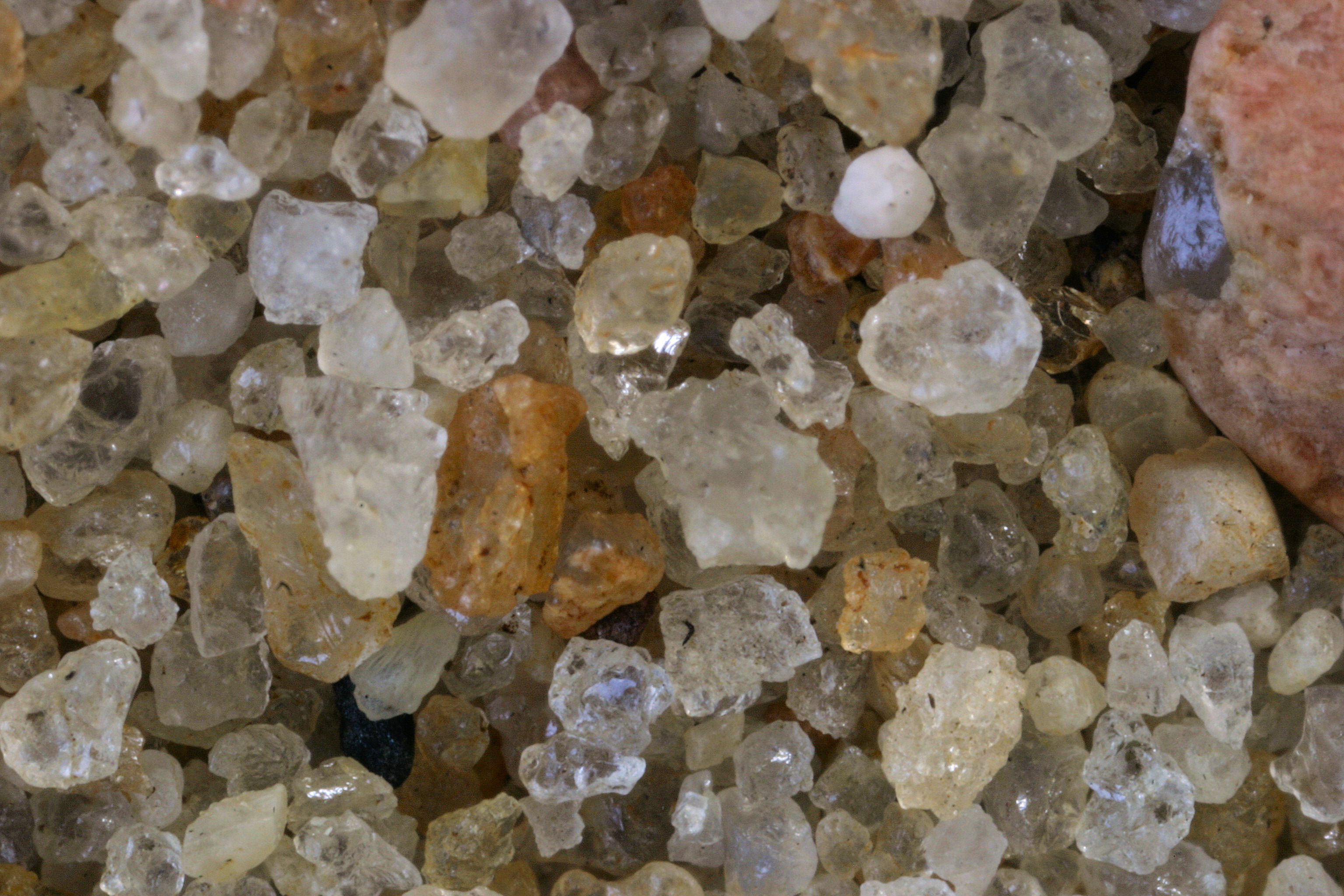
SCOTTSVILLE (3 SAMPLES) 43.02N, 77.75W
|
 |
 |
|
|
|
|
SCOTTSVILLE (3 SAMPLES) 43.02N, 77.75W
|
 |
 |
|
|
|
|
SCOTTSVILLE (3 SAMPLES) 43.02N, 77.75W
|
 |
 |
|
|
|
|
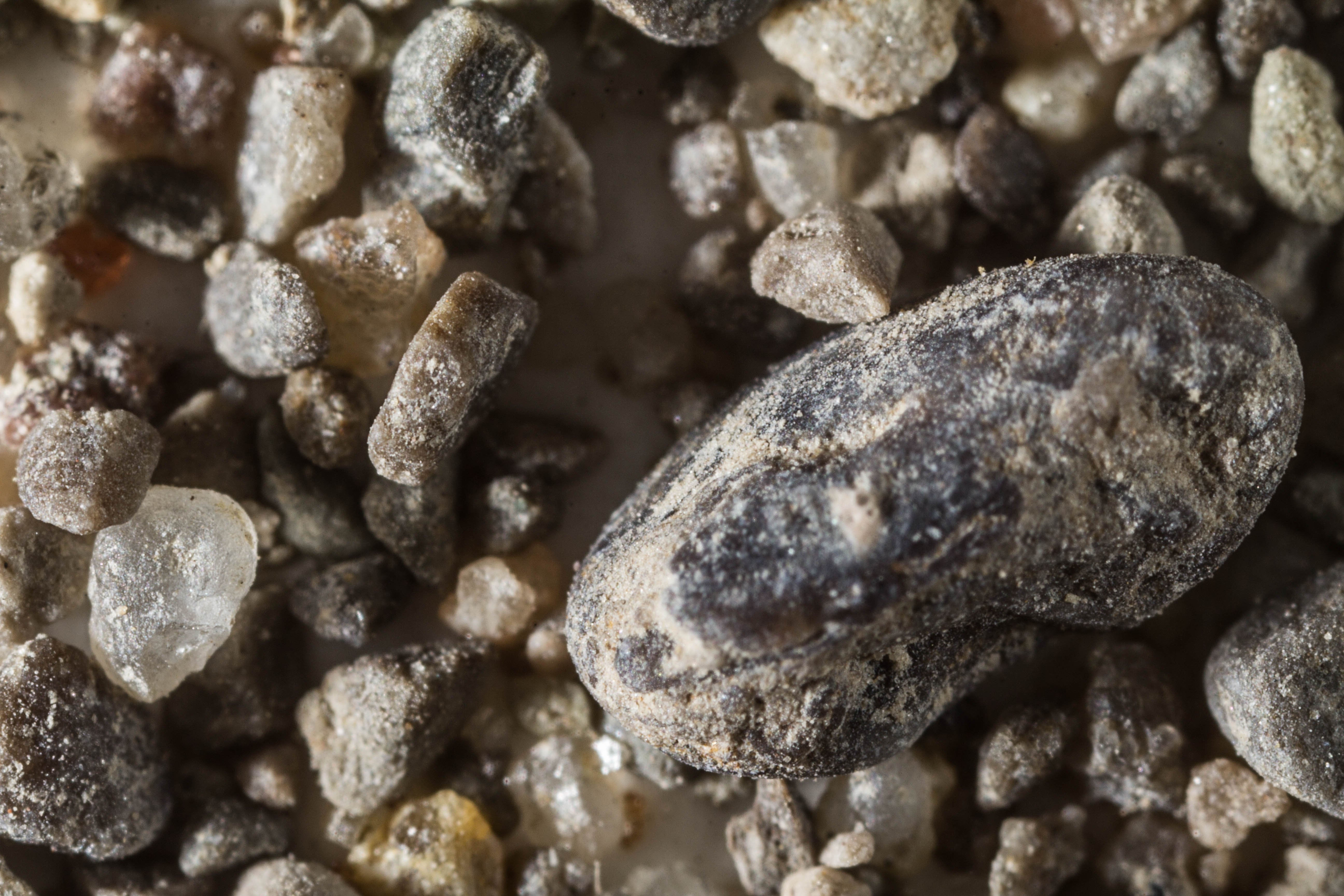
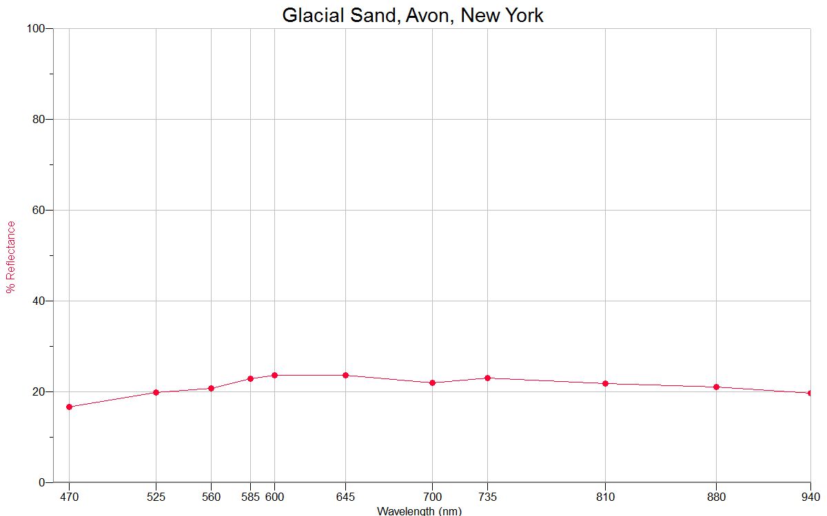
GLACIAL SAND, AVON 42.92N, 77.75W |
 |
 |
|
|
|
|
ERIE
COUNTY CONODONTS ≈42.73N,
≈78.83W |
 |
|
|
|
|
|
GENESEE R. LETCHWORTH ST. PK.
≈42.63N,
≈77.98W |
 |
 |
|
|
|
|
JERUSALEM 42.62N, 77.14W |
 |
 |
|
|
|
|
TAUGHANNOCK FALLS
42.55N, 76.61W |
 |
 |
|
|
|
|
WHITE CREEK, BELFAST - 42.20N, 78.06W |
 |
 |
LITTLE STONY
STATE PARK 41.46N, 73.96W |
 |
 |
|
|
|
|
ORIENT POINT, LONG ISLAND 41.15N, 72.29W |
 |
 |
|
|
|
|
EAST HAMPTON, 40.96N, 72.18W |
 |
|
|
|
|
|
PORT
JEFFERSON, LONG ISLAND 40.95N, 73.06W
|
 |
 |
|
|
|
|
FERRY BEACH, LONG ISLAND 40.91N, 73.55W |
 |
|
|
|
|
|
PELHAM, LONG
ISLAND SOUND 40.90, 73.81W (2X) |
 |
|
|
|
|
|
ORCHARD BEACH 40.87, 73.79W
|
 |
 |
|
|
|
|
CENTRAL
PARK, NEW YORK CITY 40.78N, 73.97W |
 |
 |
|
|
|
|
WEST
GILGO BEACH, LONG ISLAND 40.61N, 73.42W |
 |
 |
|
|
|
|
JONES BEACH, LONG ISLAND 40.59N, 73.56W |
 |
|
|
|
|
|
POINT LOOKOUT, LONG ISLAND 40.50N, 73.50W |
 |
 |