C. Ansbergs Photographs
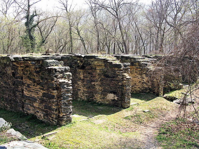
"In 1887-1888, on the former site of the Shenandoah Canal's lower locks, Thomas Savery erected this large mill to provide pulp wood for the paper industry. Ten turbines arranged in the mill's five massive sluiceways, powered wood grinders, rolling machines, and other pulp-making machinery. By the 1920's Savery's mill had the capacity to produce 15 tons of ground wood pulp daily. After several unprofitable years, the mill closed in 1935. Within a year the building was destroyed by the record flood of 1936. Its ruins reveal the last remnant of water-powered industry in Harpers Ferry." from the commemorative plaque
|
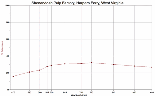
Return to West Virginia Sand to view high resolution versions of all West Virginia samples. Click the thumbnails under the images above to view high resolution versions of them.
Return to USA Map
Return to Home