Wikipedia Commons Image
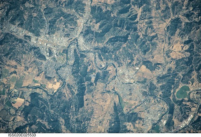
International Space Station 800mm Photograph
Image credit: Image Science and Analysis Laboratory, NASA Johnson Space Center (http://eol.jsc.nasa.gov)
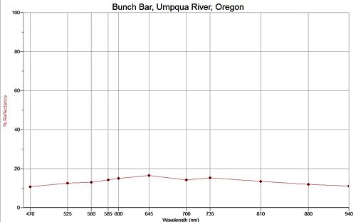
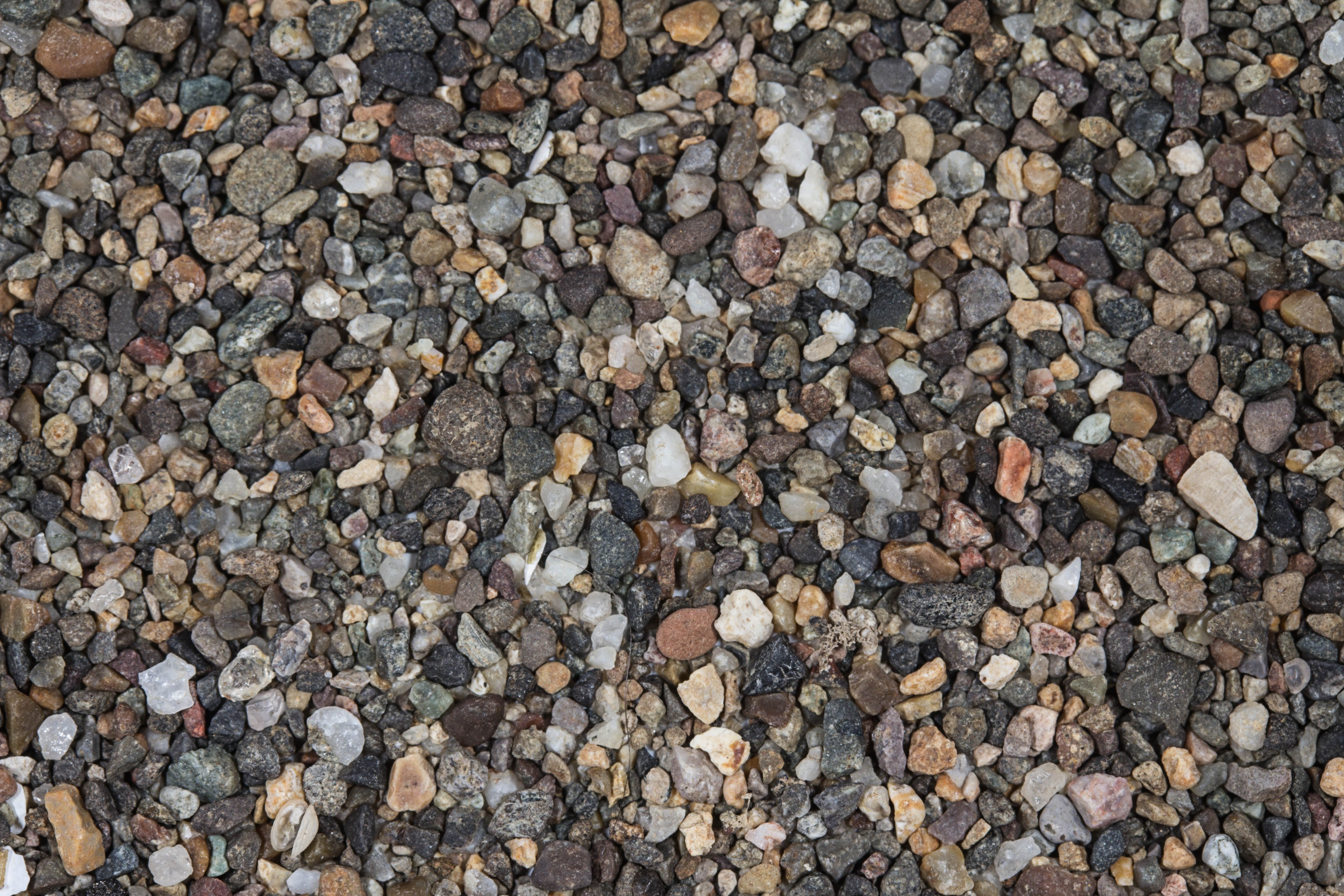
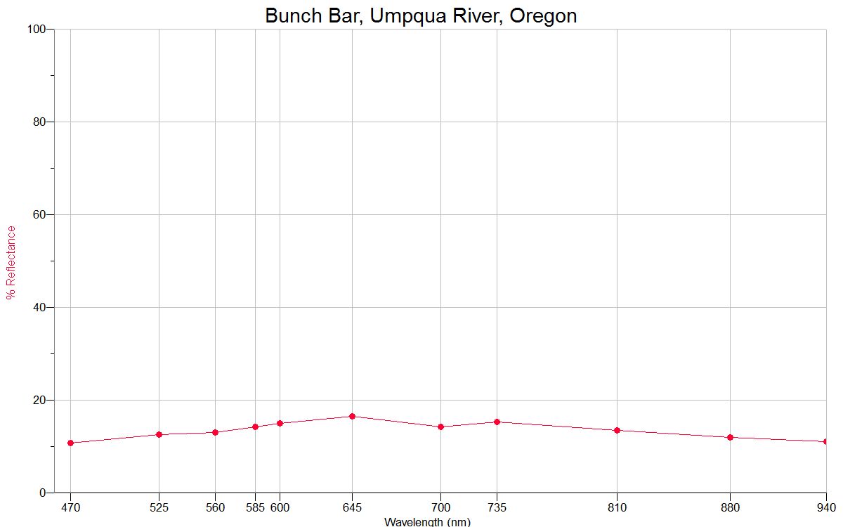
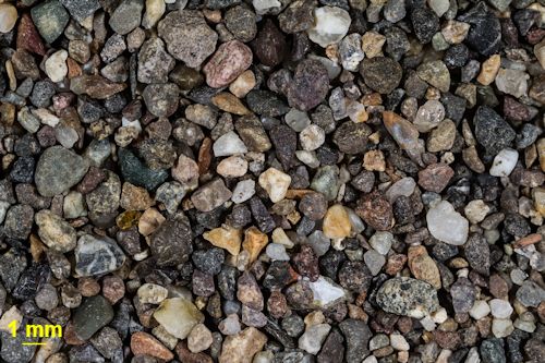
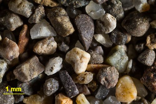
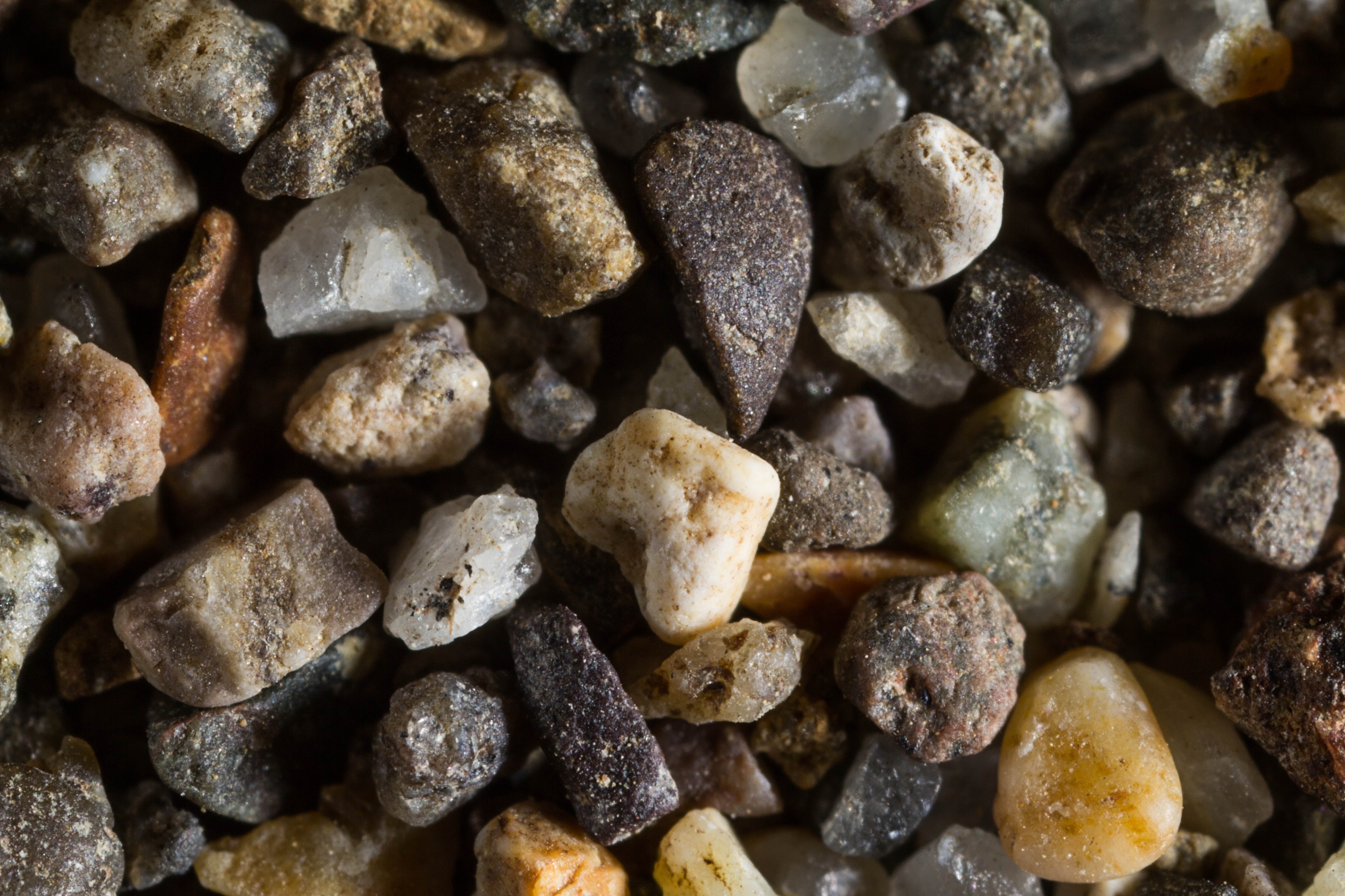
BUNCH BAR, UMPQUA RIVER 43.64N, 123.67W
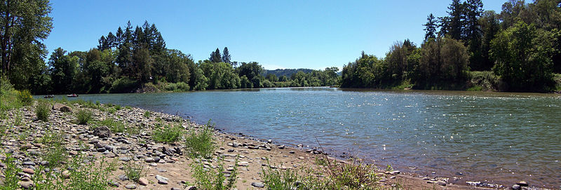
The link is to the Wikipedia page on the Umpqua River.
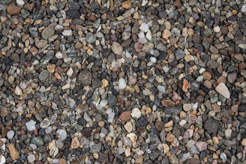
ZERO MAGNIFICATION IMAGE
1X MAGNIFICATION (YELLOW LINE = 1MM)
3X MAGNIFICATION (YELLOW LINE = 1MM)
Return to Oregon Sand
Return to USA Map
Return to Home
