Google Earth Image
C.F. Lindgren Photographs
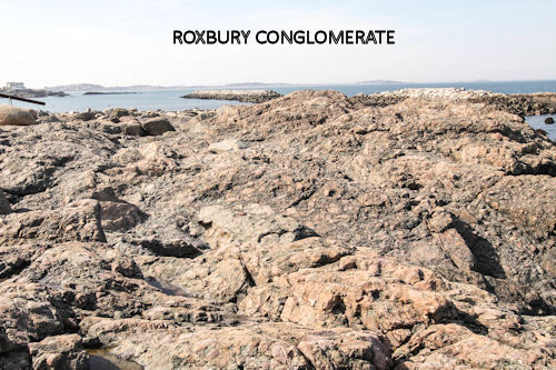
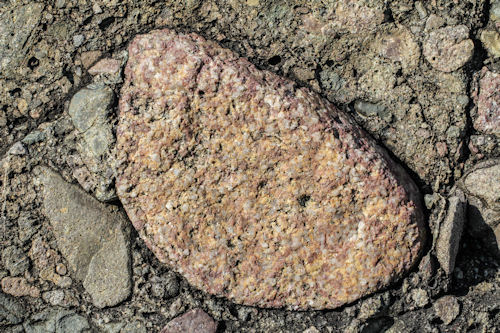
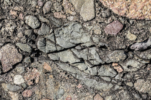
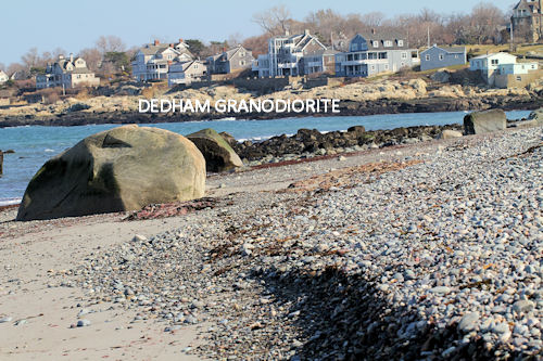
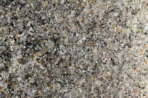
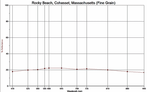
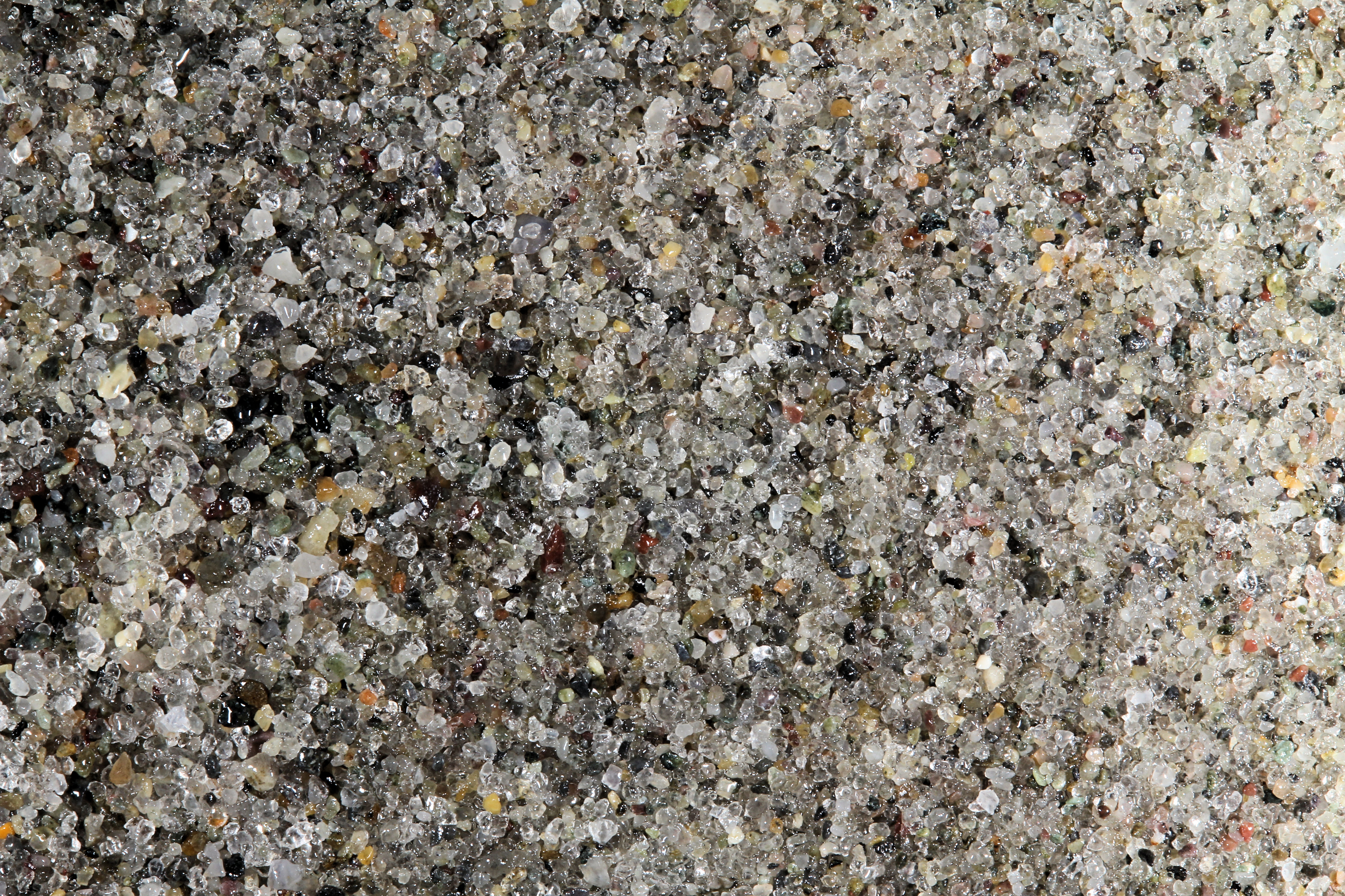
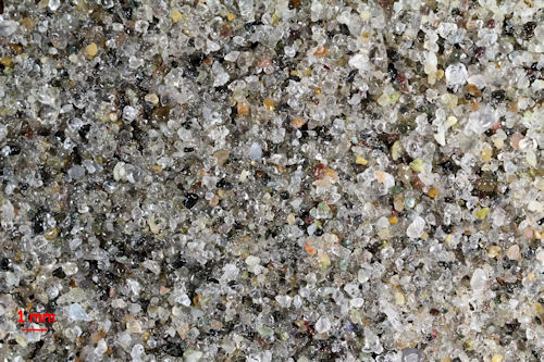
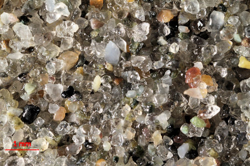
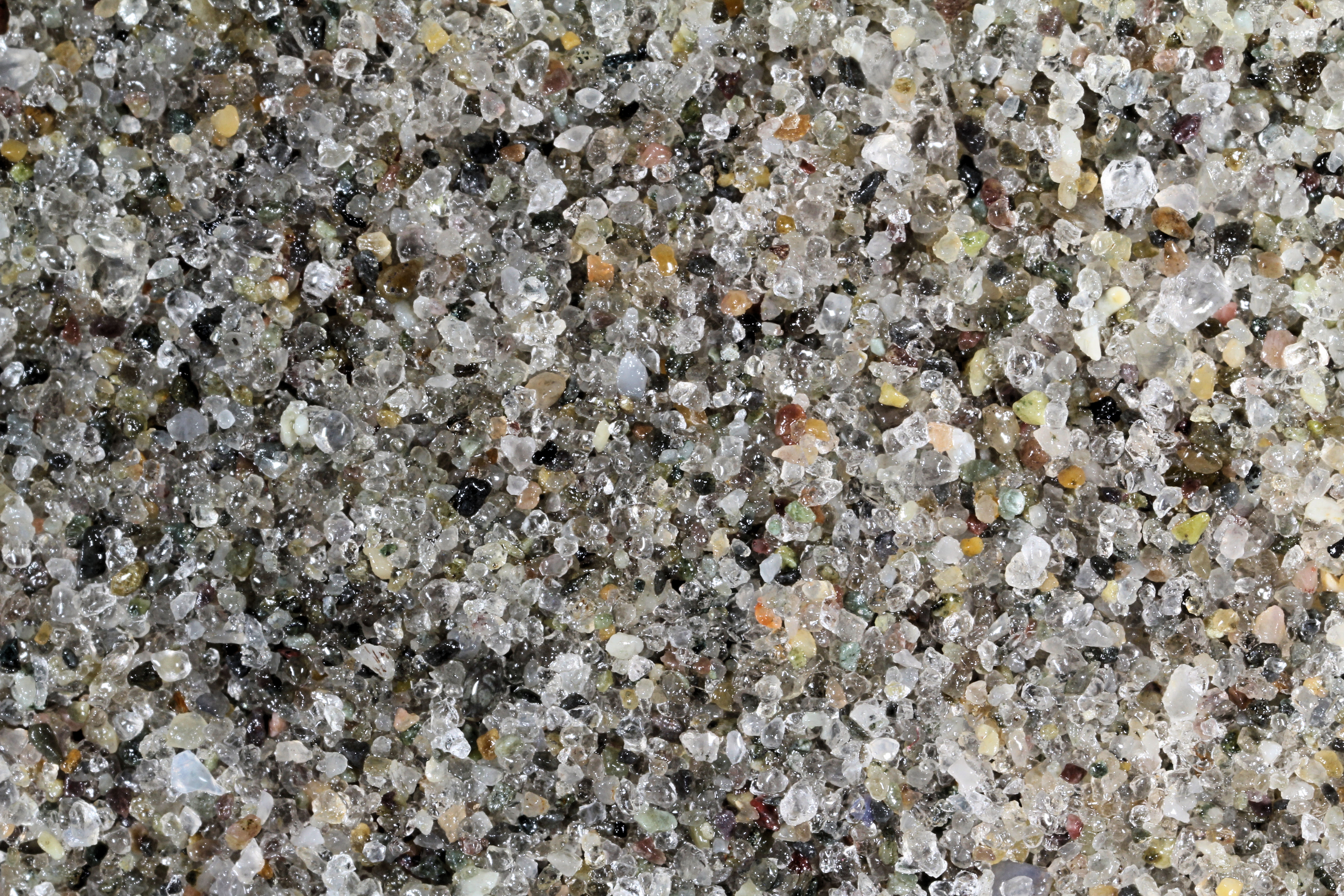
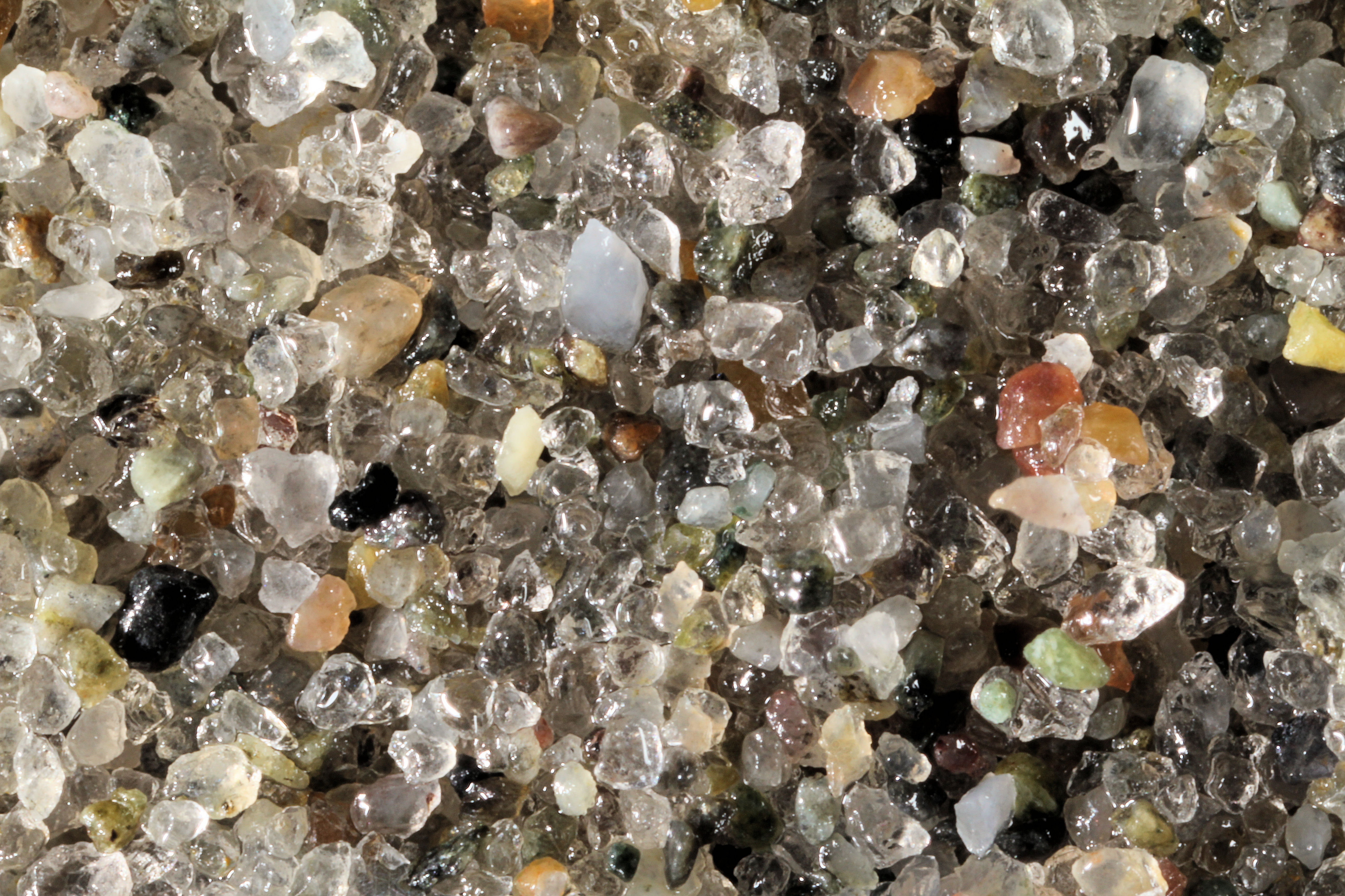
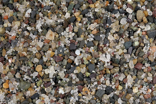
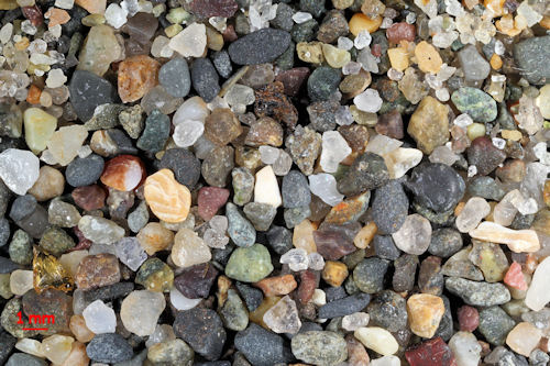
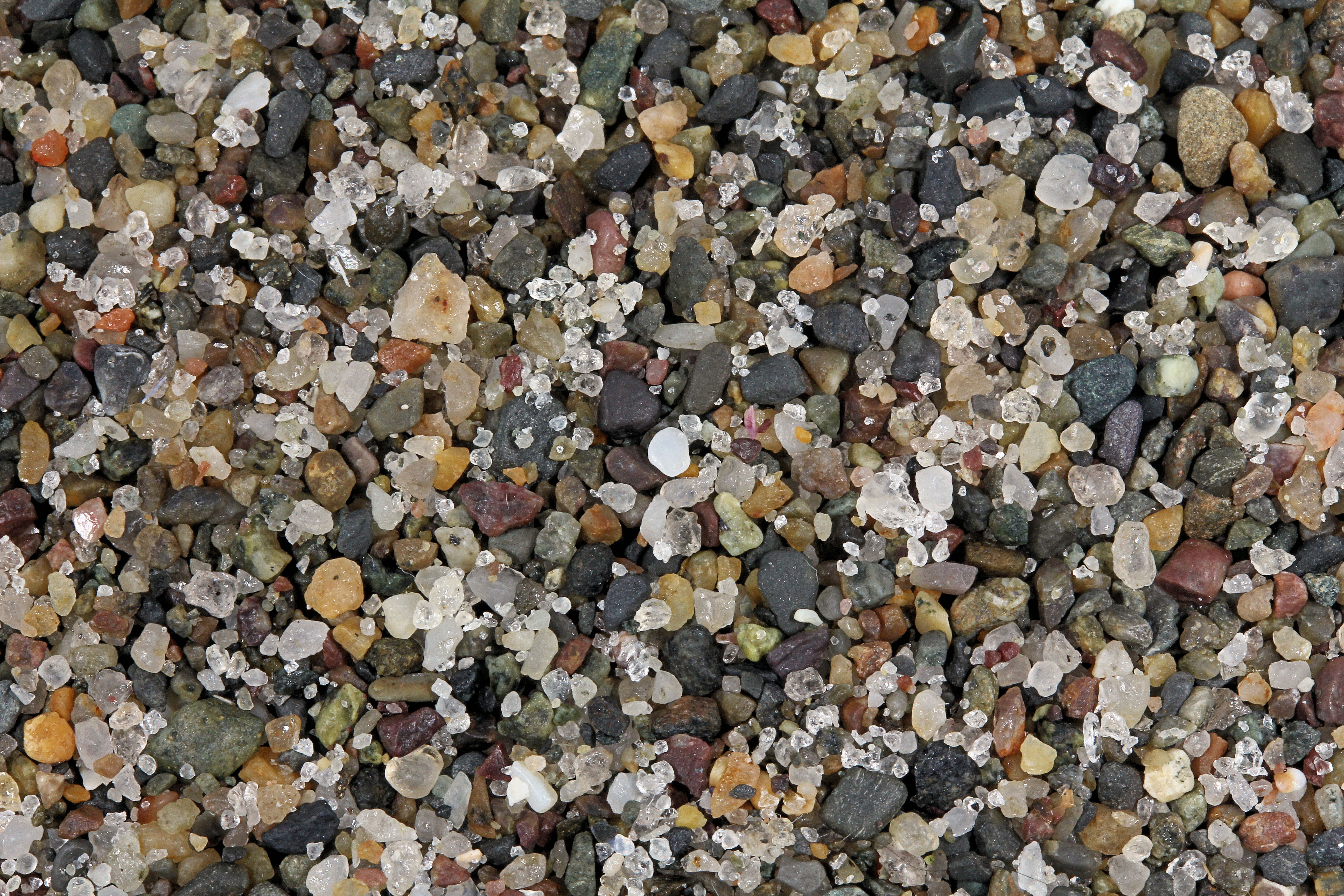
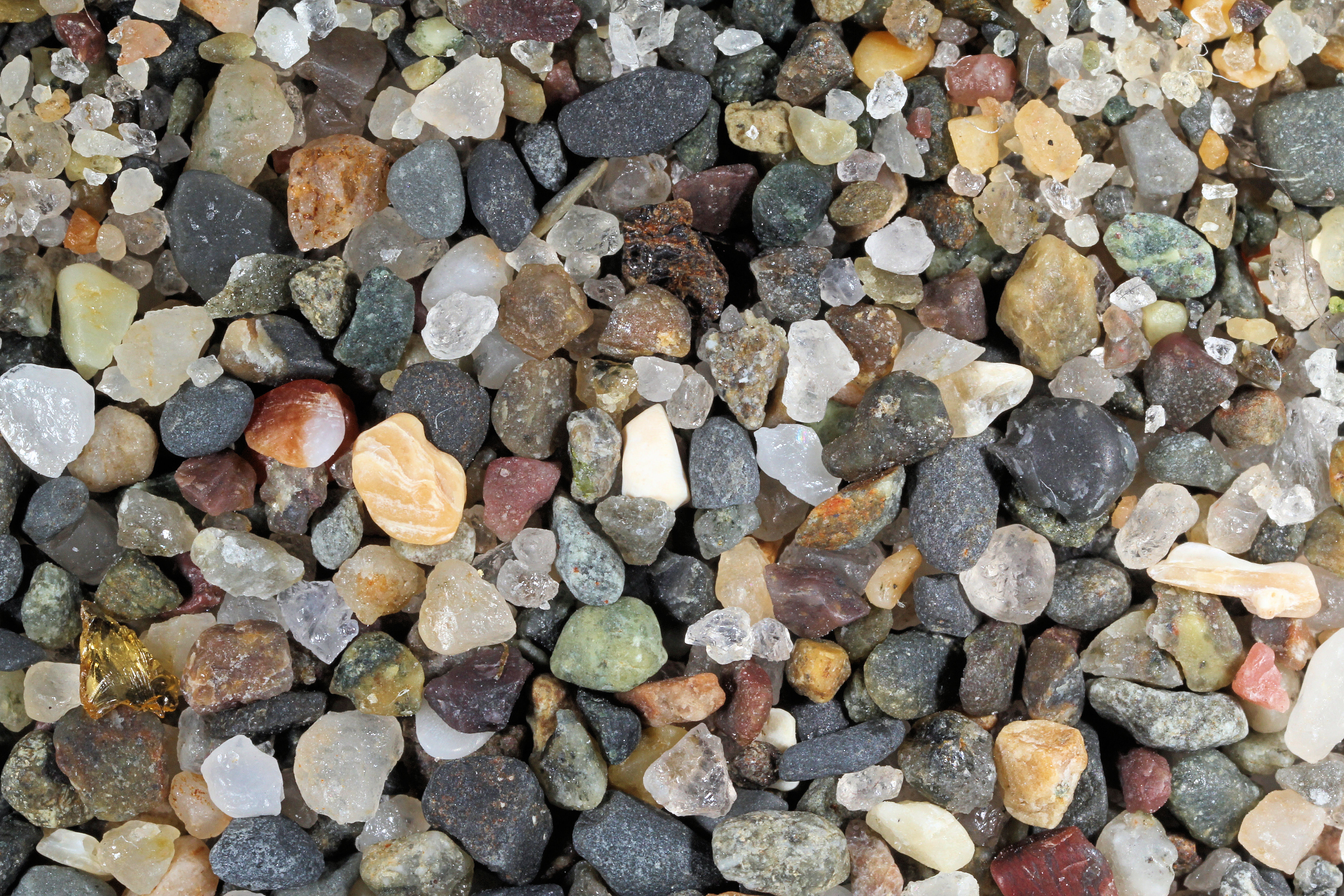
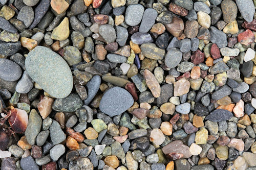
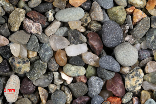
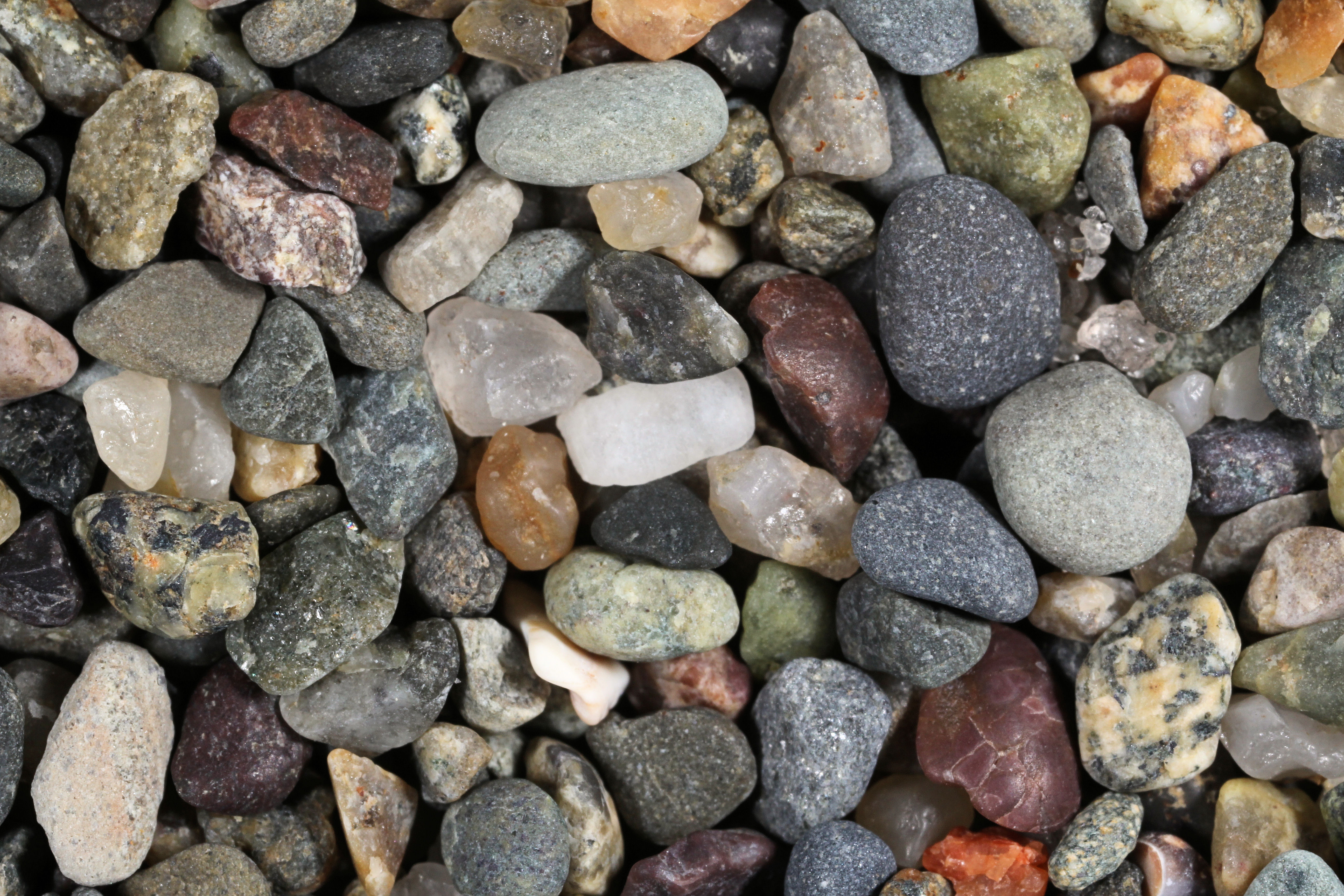
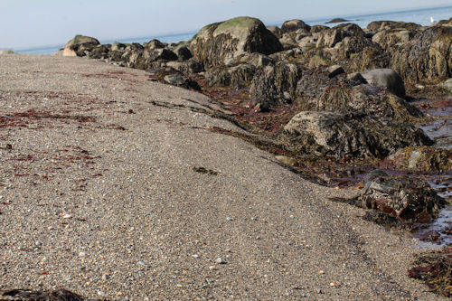
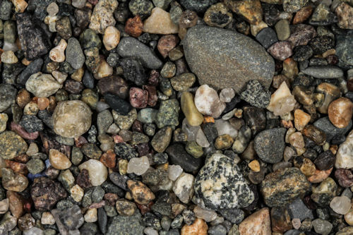
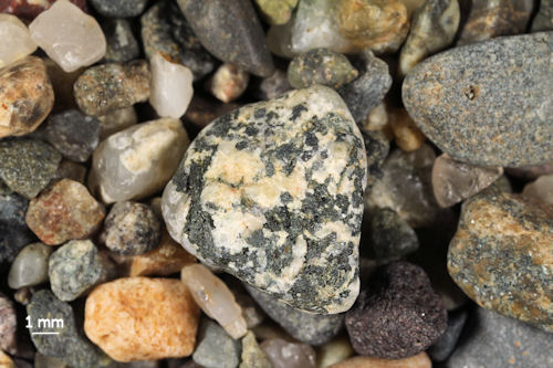
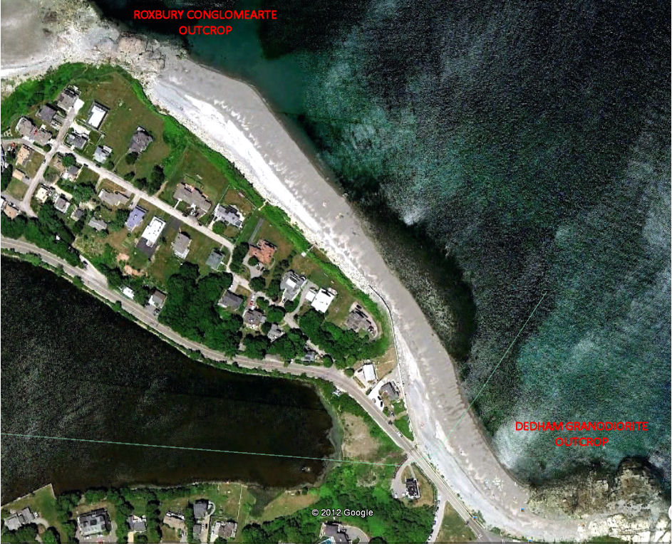
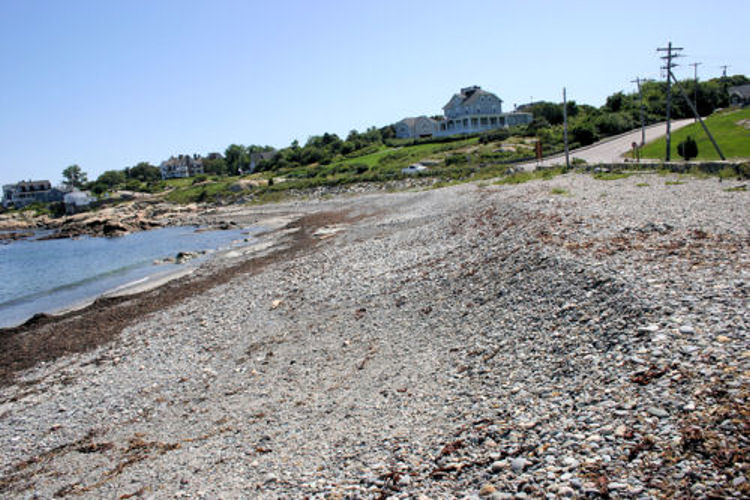
No image does Rocky Beach, a.k.a. Black Rock Beach, any justice. It is magnificent. Just as Sandy Beach is calm and inviting, Rocky is violent and dangerous. The surf pounds these rocks constantly. This picture was taken just after the passage of Tropical Storm Bill. The rocks had been thrown into a series of terraces leading from the water to the artificial wall that stops the rocks from covering the road. Sand is scarce here. This beach is a geologist's paradise. The rocks near Jerusalem Road are Dedham Granodiorite filled with basalt dikes. The granodiorite has been slightly metamorphosed, and that can clearly be seen in the boulders as the crystals change from random to banded. At the opposite end of the beach is an incredible outcrop of Roxbury Conglomerate. The samples, except for the fine-grained sample, were all taken at the 1X setting on the macro lens. Any larger setting showed only a single pebble or the depth of field was so shallow that it only allowed part of the pebble to be in focus! The samples range from high on the beach, fine grained sample, to large pebbles photographed in a berm that was at the water's edge.
|
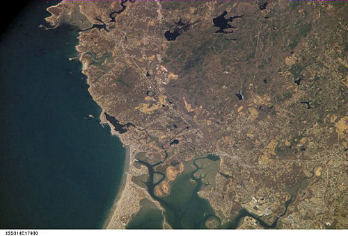
International Space Station 400mm Photograph Image credit: Image Science and Analysis Laboratory, NASA Johnson Space Center (http://eol.jsc.nasa.gov)
|
ROCKY BEACH, COHASSET - 42.24N, 70.80W
The link is to a pdf file of a poster presentation given by two undergraduate students at Bridgewater State University, Massachusetts explaining the geology of Black Rock (aka Rocky) Beach.
|
|
|
|
|
|
|
|
|
|
|
|
|
|
|
|
|
|
|
|
|
|
|
|
|
|
|
|
|
|
|
|
|
|
|
|
|
|
|
|
|
|
|
Return to Massachusetts Sand
Return to USA Map
Return to Home