|
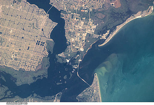
International Space Station
400mm Photograph
Image credit:
Image Science and Analysis
Laboratory, NASA Johnson Space Center (http://eol.jsc.nasa.gov) |
CALOOSAHATCHEE MARL, SOUTHERN FLORIDA
≈26.60N, ≈81.16W
The link is to a great site that
describes fossiling along the Caloosahatchee River. This
sample looks like many other samples or organic sand from
the area. The major difference is that these shells are
Pliocene, meaning they are about five million years old!
|
|
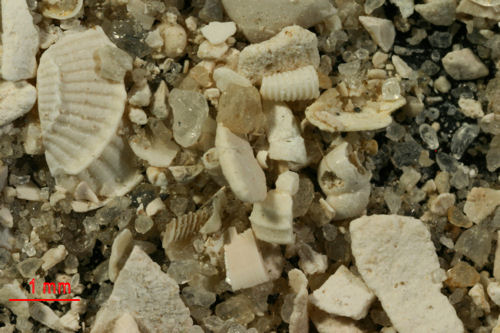
marl - Earthy mixture of fine-grained minerals, which
range widely in composition.
Lime (calcium carbonate) is present as shell fragments
of snails and
bivalves, or as powder mixed with clay and
silica-containing silt. Large deposits contain 80 – 90%
calcium carbonate and less than 3% magnesium carbonate. With
decreasing amounts of lime, calcium-containing marls are
called clays and clayey limestones. Marls rich in
potash (potassium carbonate), called greensand marls,
are used as water softeners. Marls have also been used in
the manufacture of insulating material and
portland cement, as liming material, and in making
bricks.
Britannica Concise Encyclopedia |
 |