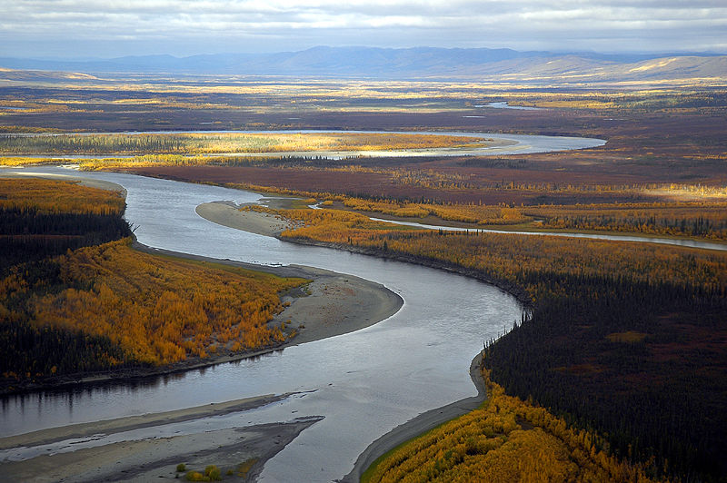
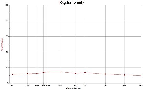
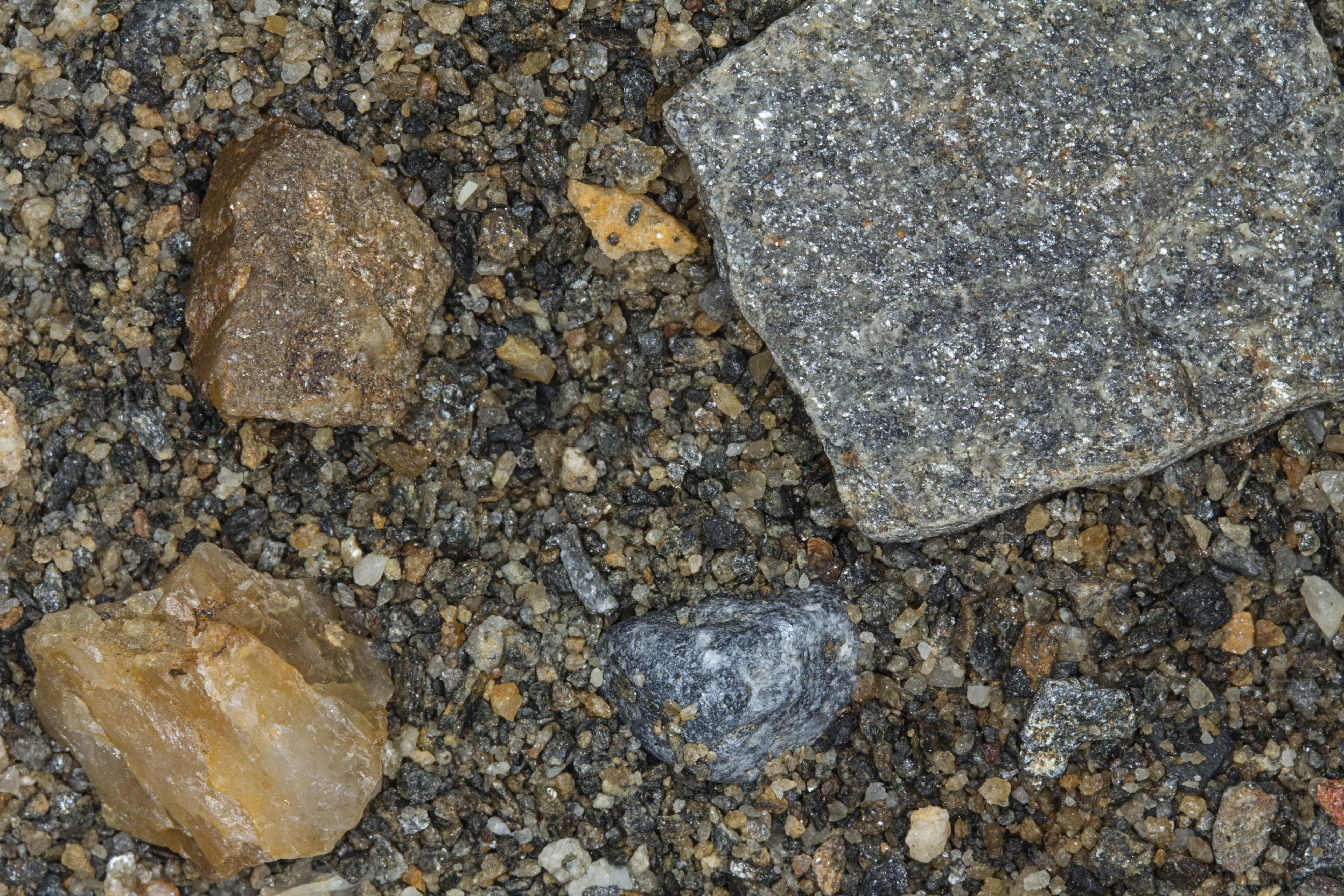
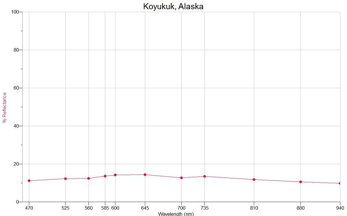
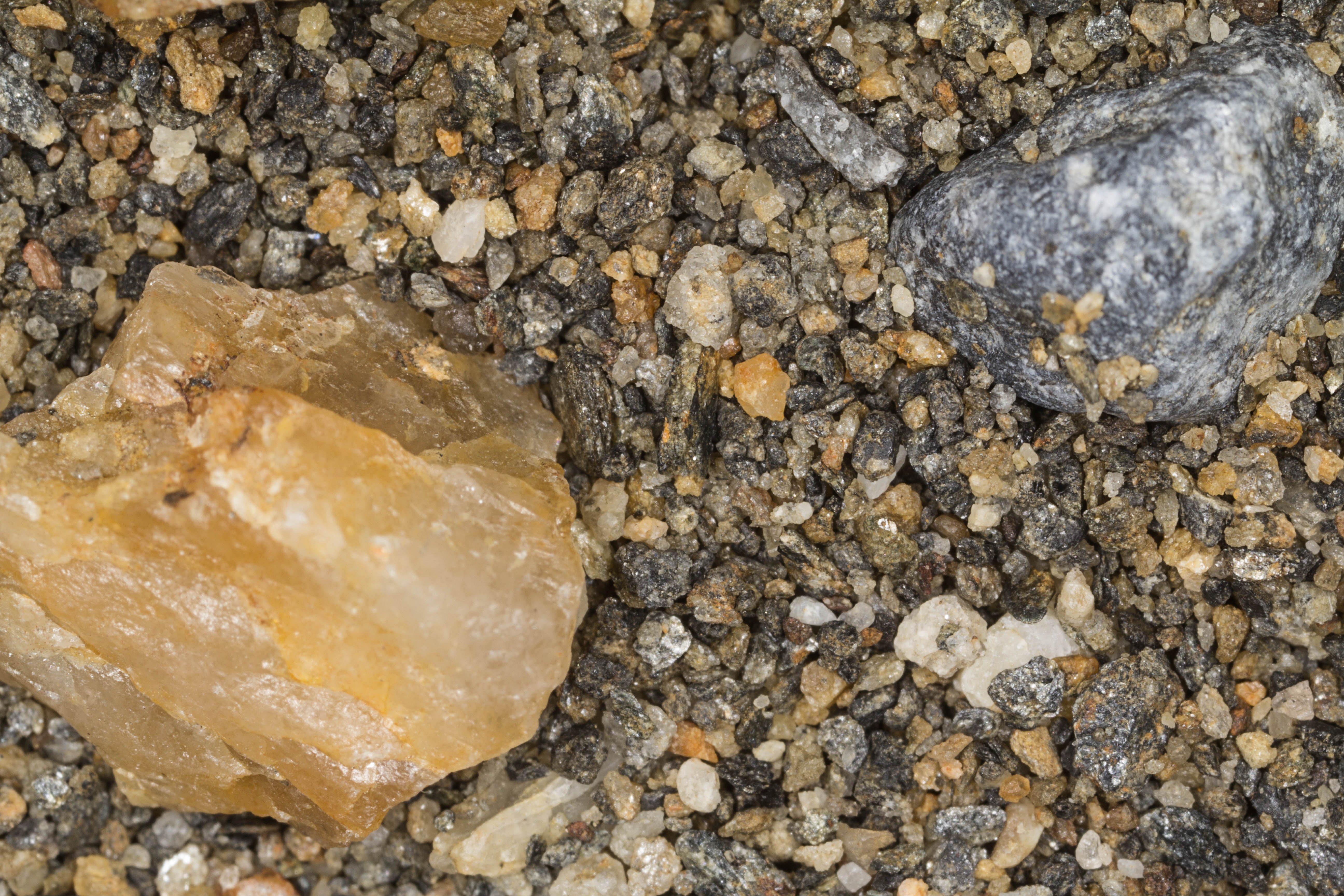
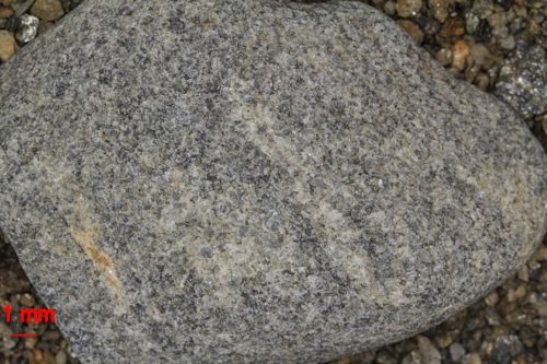
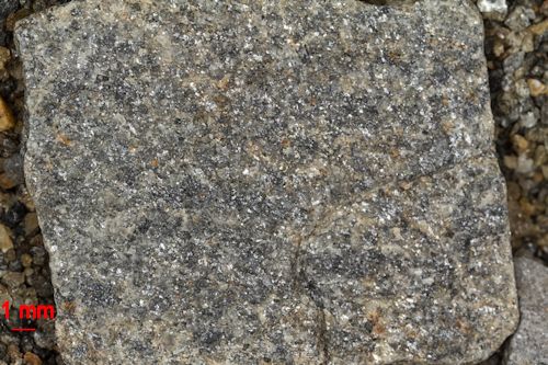
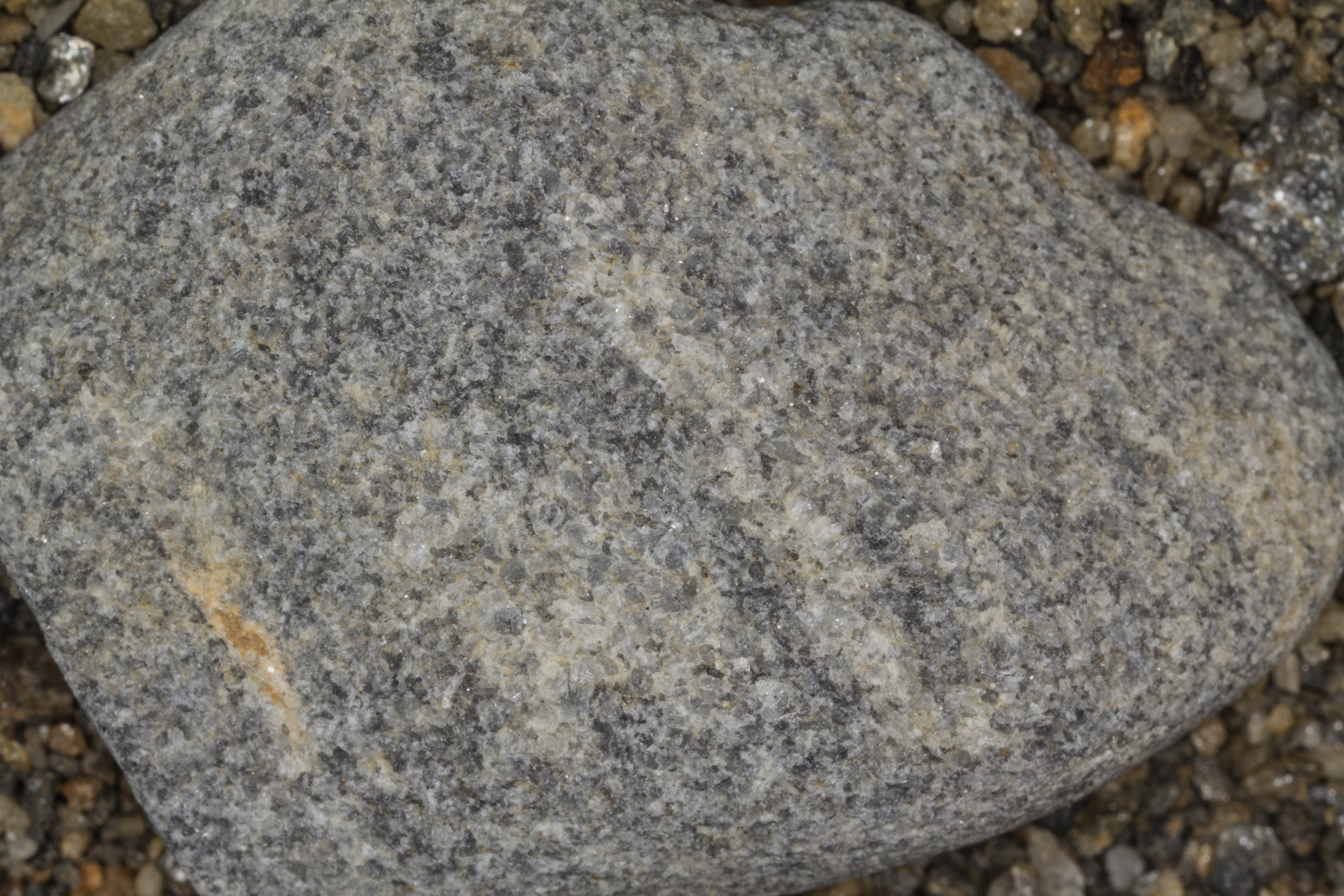
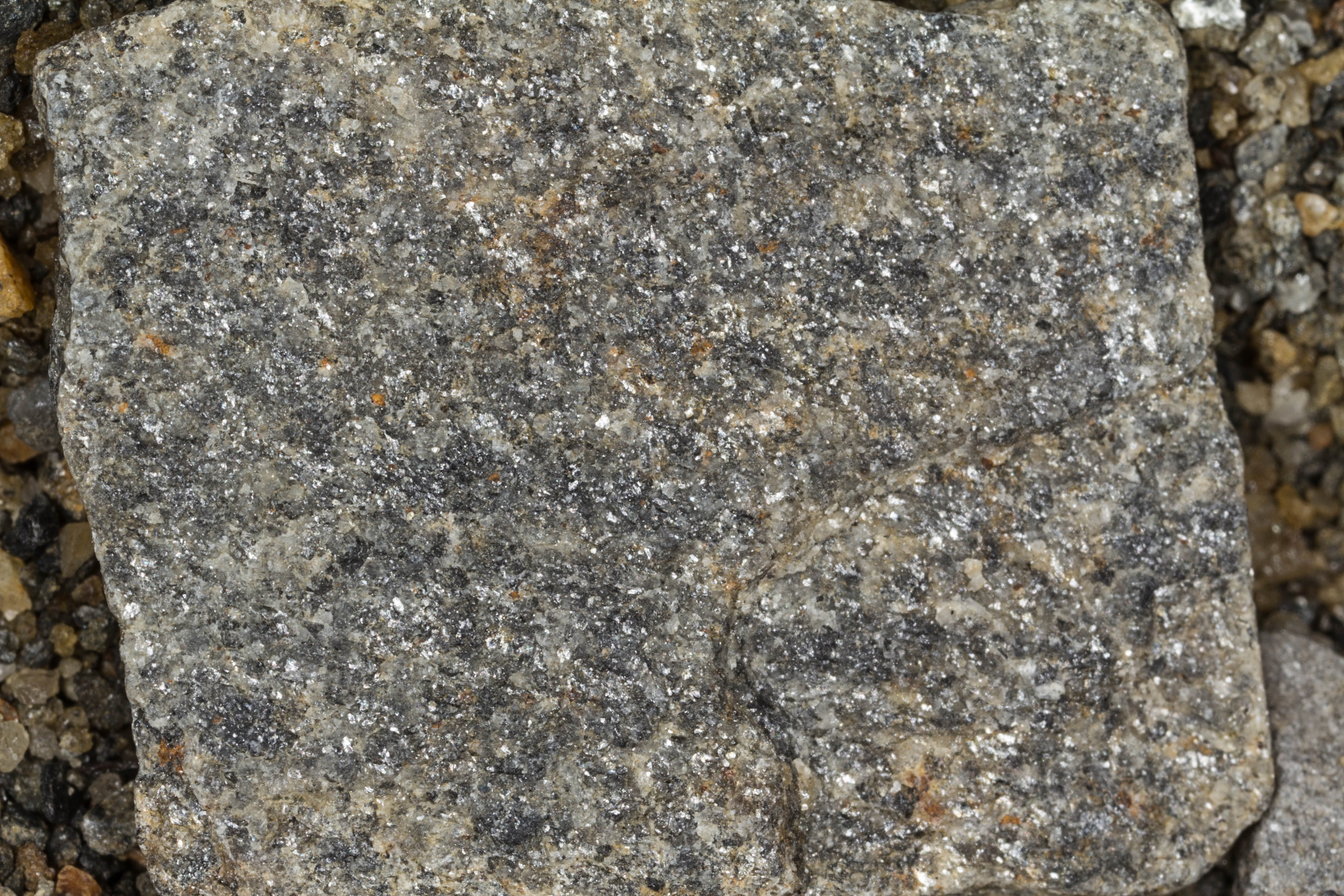
Koyukuk


Koyukuk River

Wikipedia Commons Image


Space Shuttle 100mm Photograph

Image credit:  Image Science and Analysis Laboratory, NASA Johnson Space Center (http://eol.jsc.nasa.gov)


KOYUKUK 64.88N, 157.70W

The link is to the Wikipedia page on Koyukuk.


ZERO MAGNITUDE  IMAGE

REFLECTANCE SPECTRUM

1X MAGNIFICATION (RED LINE  = 1MM)

3X MAGNIFICATION (RED LINE  = 1MM)

1X MAGNIFICATION (RED LINE  = 1MM)

1X MAGNIFICATION (RED LINE  = 1MM)

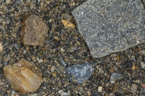
This sample was contributed by a  faculty member from the Anthony A. Andrews School in St. Michael, Alaska.

The Andrews School is a member of the Bering Strait School District.

Return to Alaskan Sand to view a high resolution version of all Alaska samples. Click the thumbnails above to view high resolution versions of these images.

Return to USA Map

Return to Home